Difference between revisions of "Banting"
| Line 7: | Line 7: | ||
|} | |} | ||
<div id="toc"> | <div id="toc"> | ||
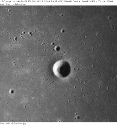
| − | [http://www.lpod.org/coppermine/albums/userpics/Banting_AS15-M-0406_LTVT.JPG [[Image: | + | [http://www.lpod.org/coppermine/albums/userpics/Banting_AS15-M-0406_LTVT.JPG [[Image:Normal_Banting_AS15-M-0406_LTVT.JPG|external image normal_Banting_AS15-M-0406_LTVT.JPG]]]<br /> ''[http://lpod.org/coppermine/displayimage.php?pos=-2489 AS15-M-0406]''<br /> <br /> |
==Images== | ==Images== | ||
[http://www.lpod.org/coppermine/thumbnails.php?album=search&type=full&search=Banting LPOD Photo Gallery] [http://www.lpi.usra.edu/resources/lunar_orbiter/bin/srch_nam.shtml?Banting%7C0 Lunar Orbiter Images] [http://www.lpi.usra.edu/resources/apollo/search/feature/?feature=Linne%20E Apollo Images]<br /> <br /> | [http://www.lpod.org/coppermine/thumbnails.php?album=search&type=full&search=Banting LPOD Photo Gallery] [http://www.lpi.usra.edu/resources/lunar_orbiter/bin/srch_nam.shtml?Banting%7C0 Lunar Orbiter Images] [http://www.lpi.usra.edu/resources/apollo/search/feature/?feature=Linne%20E Apollo Images]<br /> <br /> | ||
| Line 18: | Line 18: | ||
==Additional Information== | ==Additional Information== | ||
* IAU page: [http://planetarynames.wr.usgs.gov/Feature/597 Banting] | * IAU page: [http://planetarynames.wr.usgs.gov/Feature/597 Banting] | ||
| − | * Depth data from [[Kurt%20Fisher% | + | * Depth data from [[Kurt%20Fisher%20Crater%20Depths|Kurt Fisher database]] |
** Westfall, 2000: 1.13 km | ** Westfall, 2000: 1.13 km | ||
** Viscardy, 1985: 1.1 km | ** Viscardy, 1985: 1.1 km | ||
Latest revision as of 01:41, 16 April 2018
Contents
Banting
(formerly Linné E)
|
Lat: 26.57°N, Long: 16.42°E, Diam: 5.15 km, Depth: 1.13 km, Rükl: 23 |
Images
LPOD Photo Gallery Lunar Orbiter Images Apollo Images
Maps
(LAC zone 42A3) LAC map Geologic map LM map LTO map
Description
Wikipedia
Additional Information
- IAU page: Banting
- Depth data from Kurt Fisher database
- Westfall, 2000: 1.13 km
- Viscardy, 1985: 1.1 km
- From the length of the shadows in AS15-M-0406, the depth of the crater floor (relative to the east rim) varies from about 1070-1120 m. - Jim Mosher
- Slightly southeast of Banting is a curious craterlet with 270° ejecta blanket around it (located at 25°50' North/ 17°20' East). There's a 90° "corner" of untouched terrain westward of it. This craterlet is described and depicted in NASA SP-362, Apollo Over the Moon, Chapter 5: Craters (Part 2), Figure 112. Detection of the craterlet's exact location: Danny Caes (who calls it the Pacman). See also LROC article Nature's Art.
- To explore the LTO's extreme close-up of the Pacman southeast of Banting, add Longitude 17.35 and Latitude 25.875 in the LRO's ACT-REACT Quick Map.- DannyCaes Aug 20, 2011
Nomenclature
- Named for Sir Frederick Grant Banting (November 14, 1891 – February 21, 1941), a Canadian medical scientist, doctor and Nobel laureate noted as one of the co-discovers of insulin. Banting was widely esteemed in Canada as the first Canadian to achieve worldwide scientific fame. The Canadian government gave him a lifetime grant for his research. In 1934 King George V bestowed a knighthood on him, making him Sir Frederick Banting.
- This replacement name for a formerly lettered crater was introduced on LTO-42A3 (for which it served as the chart title). - Jim Mosher
- Biographical information for the new name appears in Ashbrook, 1974.
LPOD Articles
Bibliography
Named Featues -- Prev: Bancroft -- Next: Barbier
