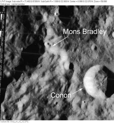
Mons Bradley
Contents
Mons Bradley
|
Lat: 22.0°N, Long: 1.0°E, Diam: 30 km, Height: 4.2 km, Rükl: 22 |
LO-IV-102H The crater Conon is also visible in this view.
Images
LPOD Photo Gallery Lunar Orbiter Images Apollo Images
The absence of orbital Apollo photographs of Mons Bradley is quite mysterious... (there's just nothing in the LPI's Apollo Image Atlas).- DannyCaes Nov 10, 2014
Instead, one should take a look at... Bradley
Maps
(LAC zone 41C1) LAC map Geologic map LM map LTO map
Description
Description: Elger
(IAU Directions) MOUNT BRADLEY.--A promontory of the Apennines, in N, lat. 23 deg., E. long. 1 deg., nearly 14,000 feet above the Mare Imbrium.
Description: Wikipedia
Additional Information
Depth data from Kurt Fisher database
- Viscardy, 1985: 4.2 km
- Cherrington, 1969: 3.68 km
Nomenclature
James; British astronomer (1693-1762).
LPOD Articles
Bibliography
