Wexler
Contents
Wexler
| Lat: 69.1°S, Long: 90.2°E, Diam: 51 km, Depth: 4.63 km, Rükl: (farside) |
Table of Contents
[#Wexler Wexler]
[#Wexler-Images Images]
[#Wexler-Maps Maps]
[#Wexler-Description Description]
[#Wexler-Description: Wikipedia Description: Wikipedia]
[#Wexler-Additional Information Additional Information]
[#Wexler-Nomenclature Nomenclature]
[#Wexler-LPOD Articles LPOD Articles]
[#Wexler-Bibliography Bibliography]


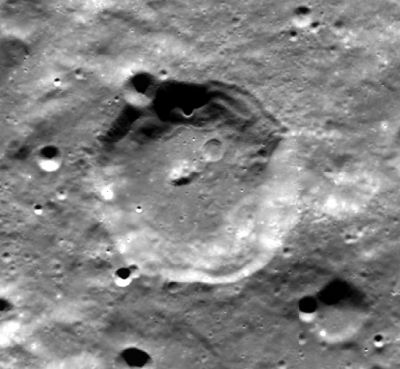
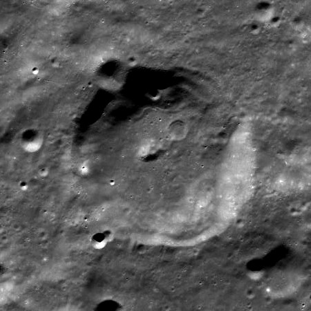
left: Clementine . right: LROC
Images
LPOD Photo Gallery Lunar Orbiter Images Apollo Images
- Sunset at Wexler, as seen by a Hasselblad camera of Apollo 15, and captured on color film: AS15-96-13093. In this photograph, the location of Wexler is at the frame's lower part. See also the Hi-Res scan: AS15-96-13093 HR.
- Research: Danny Caes.
Maps
(LAC zone 139B3) USGS Digital Atlas PDF
Description
Description: Wikipedia
Additional Information
Depth data from Kurt Fisher database
- Westfall, 2000: 4.63 km
Nomenclature
- Harry Wexler (1911–August 11, 1962) was an American meteorologist. He worked for the United States Weather Bureau from 1934 until 1942, then served as a Major with the weather service of the Army Air Corps during World War II. On September 14, 1944, Major Harry Wexler became the first scientist to deliberately fly into a hurricane.
  - A broad and shallow valley west-northwest of Wexler is unofficially called Vallis Wexler by D.Caes.
LPOD Articles
Bibliography
This page has been edited 1 times. The last modification was made by - tychocrater tychocrater on Jun 13, 2009 3:24 pm - afx2u2