Ritz
Contents
Ritz
| Lat: 15.1°S, Long: 92.2°E, Diam: 51 km, Depth: 3.75 km, Rükl: (farside) |
Table of Contents
[#Ritz Ritz]
[#Ritz-Images Images]
[#Ritz-Maps Maps]
[#Ritz-Description Description]
[#Ritz-Description: Wikipedia Description: Wikipedia]
[#Ritz-Additional Information Additional Information]
[#Ritz-Nomenclature Nomenclature]
[#Ritz-LPOD Articles LPOD Articles]
[#Ritz-Bibliography Bibliography]


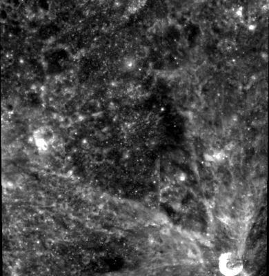
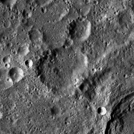
left: Clementine . right: LROC . Ritz is the eroded crater at center; NW rim of [/Sklodowska Sklodowska] visible at bottom right edge.
Images
LPOD Photo Gallery Lunar Orbiter Images Apollo Images
- Two orbital high-sun south looking close up photographs of Ritz were made during the mission of Apollo 8. These frames are:
AS8-13-2264: Ritz is the large crater at (and a little bit below) the centre of the frame. The eastern part of nearby Sklodowska is visible near the frame's upper left corner.
AS8-13-2265: Ritz is visible near the frame's left margin.
Research: Danny Caes
HiRes scans of Apollo 8 photography: David Woods and Frank O'Brien (Apollo 8 Flight Journal)
Maps
([/LAC%20zone LAC zone] 82D4) USGS Digital Atlas PDF
Description
Description: Wikipedia
Additional Information
Depth data from [/Kurt%20Fisher%20crater%20depths Kurt Fisher database]
- Pike, 1976: 3.75 km
Nomenclature
Walter; Swiss physicist (1878-1909).
LPOD Articles
Bibliography
This page has been edited 1 times. The last modification was made by - tychocrater tychocrater on Jun 13, 2009 3:24 pm - afx4