Nansen-Apollo
Contents
Nansen-Apollo (Apollo 17 site craterlet name)
|
Lat: 20.1°N, Long: 30.5°E, Diam: 1 km, Depth: km, [/R%C3%BCkl%2025 Rükl: 25] |


Table of Contents
[#Nansen-Apollo (Apollo 17 site craterlet name) Nansen-Apollo (Apollo 17 site craterlet name)]
[#Nansen-Apollo (Apollo 17 site craterlet name)-Images Images]
[#Nansen-Apollo (Apollo 17 site craterlet name)-Maps Maps]
[#Nansen-Apollo (Apollo 17 site craterlet name)-Description Description]
[#Nansen-Apollo (Apollo 17 site craterlet name)-Description: Wikipedia Description: Wikipedia]
[#Nansen-Apollo (Apollo 17 site craterlet name)-Additional Information Additional Information]
[#Nansen-Apollo (Apollo 17 site craterlet name)-Nomenclature Nomenclature]
[#Nansen-Apollo (Apollo 17 site craterlet name)-LPOD Articles LPOD Articles]
[#Nansen-Apollo (Apollo 17 site craterlet name)-Bibliography Bibliography]
Images
LPOD Photo Gallery Lunar Orbiter Images Apollo Images from air
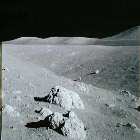
- Apollo images from ground (Nansen-Apollo is Station 2 on EVA 2): Magazine C (137)
- Subtle colorations on boulder, at Station 2: AS17-137-20965 and AS17-137-20968 are two of a series of eleven close-up photographs of a colored boulder at Apollo 17's Station 2 (near Nansen-Apollo). Note the contrasting blue-grey and yellowish-grey colors! - DannyCaes DannyCaes Jan 29, 2008
Maps
([/LAC%20zone LAC zone] 43D1) LAC map Geologic map LTO map Topophotomap Site Traverses chart
IAU page
Description
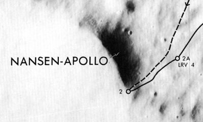
The [/Landing%20Site%20Name Landing Site Name] "Nansen-Apollo" is plotted on Topophotomap 43D1/S1 and Site Traverses chart 43D1S2. It has been described as a trough at the base of the [/South%20Massif South Massif].
Description: Wikipedia
Nansen-Apollo (correct link)
Additional Information
Nomenclature
- Astronaut-named feature, [/Apollo%2017%20site Apollo 17 site], approved in [/IAU%20Transactions%20XVIB IAU Transactions XVIB] (1976).
- Apollo 17 astronaut Harrison Schmitt recalled this crater was "named for Fridtjof Nansen (1861-1930), Norwegian Arctic explorer, statesman, and Nobel Peace Prize winner (1922). His studies of oceanography, meteorology, and nutrition underlay all future exploration work in the Arctic. Nansen represents the international character of all of mankind's exploration - past, present, and future." Perhaps unknown to the astronauts the 104-km diameter crater [/Nansen Nansen] near the Moon's north pole had already been named for the same man. Hence the hyphenated suffix was added to distinguish this Nansen from the other.
LPOD Articles
Bibliography
David M. Harland: EXPLORING THE MOON; The Apollo Expeditions.
  Eric M. Jones: APOLLO LUNAR SURFACE JOURNAL (ALSJ).
This page has been edited 1 times. The last modification was made by - tychocrater tychocrater on Jun 13, 2009 3:24 pm - afx3u2