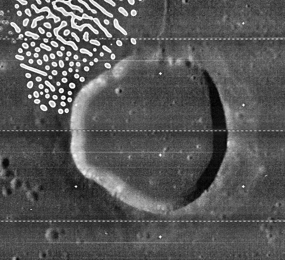
Maclear
Contents
Maclear
| Lat: 10.5°N, Long: 20.1°E, Diam: 20 km, Depth: 0.61 km, Rükl: 35 |
Table of Contents
[#Maclear Maclear]
[#Maclear-Images Images]
[#Maclear-Maps Maps]
[#Maclear-Description Description]
[#Maclear-Description: Elger Description: Elger]
[#Maclear-Description: Wikipedia Description: Wikipedia]
[#Maclear-Additional Information Additional Information]
[#Maclear-Ranger 6 Ranger 6]
[#Maclear-Small field of irregular Mare Patches (IMPs) south-southeast of Maclear (known as Maclear 2) Small field of irregular Mare Patches (IMPs) south-southeast of Maclear (known as Maclear 2)]
[#Maclear-Nomenclature Nomenclature]
[#Maclear-LPOD Articles LPOD Articles]
[#Maclear-Bibliography Bibliography]

LO4-085-h2
Images
LPOD Photo Gallery Lunar Orbiter Images Apollo Images
Maps
([/LAC%20zone LAC zone] 60B4) LAC map Geologic map LM map LTO map
Description
Description: Elger
([/IAU%20Directions IAU Directions]) MACLEAR.--A conspicuous ring-plain about 16 miles in diameter. The dark floor includes, according to Madler, a delicate central hill which Schmidt does not show. Neison, however, saw a faint greyish mark, and an undoubted peak has been subsequently recorded. I have not succeeded in seeing any detail within the border, which in shape resembles a triangle with curved sides.
Description: Wikipedia
Additional Information
Depth data from [/Kurt%20Fisher%20crater%20depths Kurt Fisher database]
- Arthur, 1974: 0.61 km
- Westfall, 2000: 0.61 km
- Viscardy, 1985: 0.61 km
- Cherrington, 1969: 0.7 km
Ranger 6
Southeast of Maclear, near four unnamed dome-like formations (north-northwest of the large dome Arago Alpha), is (or should be) the impact location of Ranger 6, which was an unsuccessful attempt to make close-up photographs of the moon while the probe descended toward the lunar surface.
  The exact coordinates of Ranger 6's impact location are: 9°24' North/ 21°30' East.
  Note that chart 35 of Antonin Rukl's Atlas of the Moon doesn't show the location of Ranger 6.
  Additional research Danny Caes
Small field of irregular Mare Patches (IMPs) south-southeast of Maclear (known as Maclear 2)
The exact coordinates of this small IMP field to the south-southeast of Maclear are: LAT 9.102 / LON 20.298
Nomenclature
- Sir Thomas Maclear (January 17, 1794–July 14, 1879) was an Irish-born South African astronomer. Dr. Maclear had a keen interest in amateur astronomy, and would begin a long association with the Royal Astronomical Society, to which he would be named a Fellow. In 1833 he was named as royal astronomer at the Cape of Good Hope, and arrived there to take up his new duties in 1834. He worked with John Herschel until 1834, performing a survey of the southern sky. He continued to perform important astronomical observations for several decades.
- [/Ireland Related material] on other features named after Irish scientists.
- Maclear 2 (the small field of Irregular Mare Patches (IMPs) south-southeast of Maclear).
LPOD Articles
Bibliography
A Portfolio of Lunar Drawings (Harold Hill), pages 9 and 11.
This page has been edited 1 times. The last modification was made by - tychocrater tychocrater on Jun 13, 2009 3:24 pm - afx3u2