Difference between revisions of "Dunér"
(Created page with "<div id="content_view" class="wiki" style="display: block"> =Dunér= {| class="wiki_table" | Lat: 44.8°N, Long: 179.5°E, Diam: 62 km, Depth: km, Rükl: ''(farside)'', ...") |
|||
| Line 13: | Line 13: | ||
|} | |} | ||
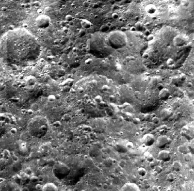
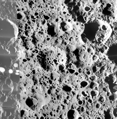
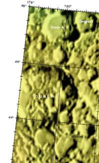
'''Left:''' [http://www.mapaplanet.org/explorer-bin/explorer.cgi?map=Moon&layers=moon_clementine_base_v2&info=NO&advoption=NO&sizeSelector=imageSize&lines=1058&samples=2824&Resolution=26.977455101261&r=1&g=1&b=1&projection=SIMP&grid=none&stretch=auto&north=33.71&south=53.29&west=153.83&east=206.17¢er_lat=0¢er=180&defaultcenter=on Clementine] view. '''Middle:''' [http://www.mapaplanet.org/explorer-bin/explorer.cgi?map=Moon&layers=moon_lo&west=153.83&south=33.70&east=206.17&north=53.30¢er_lat=0¢er=180&defaultcenter=on&grid=none&stretch=auto&projection=SIMP&advoption=NO&info=NO&resolution=53.954910202522 Lunar Orbiter] view - both images from [http://www.mapaplanet.org Map-A-Planet]. '''Right:''' [http://planetarynames.wr.usgs.gov/images/Lunar/lac_33.pdf Color-coded topography LAC33] from [[USGS%20Digital%20Atlas|USGS Digital Atlas]]. Dunér is the crater at the exact centre of image having several smaller crater within its barely perceptible rim-surround. <div id="toc"> | '''Left:''' [http://www.mapaplanet.org/explorer-bin/explorer.cgi?map=Moon&layers=moon_clementine_base_v2&info=NO&advoption=NO&sizeSelector=imageSize&lines=1058&samples=2824&Resolution=26.977455101261&r=1&g=1&b=1&projection=SIMP&grid=none&stretch=auto&north=33.71&south=53.29&west=153.83&east=206.17¢er_lat=0¢er=180&defaultcenter=on Clementine] view. '''Middle:''' [http://www.mapaplanet.org/explorer-bin/explorer.cgi?map=Moon&layers=moon_lo&west=153.83&south=33.70&east=206.17&north=53.30¢er_lat=0¢er=180&defaultcenter=on&grid=none&stretch=auto&projection=SIMP&advoption=NO&info=NO&resolution=53.954910202522 Lunar Orbiter] view - both images from [http://www.mapaplanet.org Map-A-Planet]. '''Right:''' [http://planetarynames.wr.usgs.gov/images/Lunar/lac_33.pdf Color-coded topography LAC33] from [[USGS%20Digital%20Atlas|USGS Digital Atlas]]. Dunér is the crater at the exact centre of image having several smaller crater within its barely perceptible rim-surround. <div id="toc"> | ||
| − | + | <br /> <br /> | |
| − | |||
==Images== | ==Images== | ||
[http://www.lpod.org/coppermine/thumbnails.php?album=search&type=full&search=Duner LPOD Photo Gallery] [http://www.lpi.usra.edu/resources/lunar_orbiter/bin/srch_nam.shtml?Duner%7C0 Lunar Orbiter Images] [http://www.lpi.usra.edu/resources/apollo/search/feature/?feature=Duner Apollo Images]<br /> <br /> | [http://www.lpod.org/coppermine/thumbnails.php?album=search&type=full&search=Duner LPOD Photo Gallery] [http://www.lpi.usra.edu/resources/lunar_orbiter/bin/srch_nam.shtml?Duner%7C0 Lunar Orbiter Images] [http://www.lpi.usra.edu/resources/apollo/search/feature/?feature=Duner Apollo Images]<br /> <br /> | ||
| Line 34: | Line 33: | ||
<br /> <br /> | <br /> <br /> | ||
---- | ---- | ||
| − | + | </div> | |
Revision as of 17:21, 15 April 2018
Contents
Dunér
|
Lat: 44.8°N, Long: 179.5°E, Diam: 62 km, Depth: km, Rükl: (farside), pre-Nectarian | ||
Images
LPOD Photo Gallery Lunar Orbiter Images Apollo Images
Maps
(LAC zone 33A1) USGS Digital Atlas PDF
Description
Description: Wikipedia
Additional Information
Nomenclature
Nils Christofer Dunér (May 21, 1839 - November 10, 1914) was a Swedish astronomer. Dunér received his doctorate from Lund University in 1862, was observer at the observatory there from 1864 and Professor of Astronomy at Uppsala University from 1888.
Lettered Craters

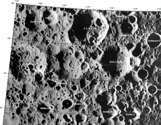
Excerpt from the USGS Digital Atlas of the Moon.
LPOD Articles
Bibliography


