Difference between revisions of "Douglass"
| Line 13: | Line 13: | ||
|} | |} | ||
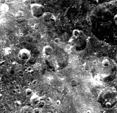
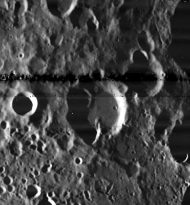
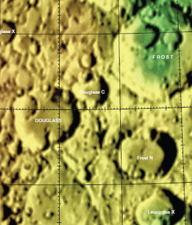
'''Left:''' [http://www.mapaplanet.org/explorer-bin/explorer.cgi?map=Moon&layers=moon_clementine_base_v2&info=NO&advoption=NO&sizeSelector=imageSize&lines=724&samples=1440&Resolution=34.218009478673&r=1&g=1&b=1&projection=SIMP&grid=none&stretch=auto&north=29.64&south=40.19&west=227.26&east=248.30¢er_lat=0¢er=237.78&defaultcenter=on Clementine] image from [http://www.mapaplanet.org Map-A-Planet].<br /> '''Middle:''' Mosaic image from Lunar Orbiter 5's [http://www.lpi.usra.edu/resources/lunarorbiter/images/preview/5024_h2.jpg 5024-H2] and [http://www.lpi.usra.edu/resources/lunarorbiter/images/preview/5024_h3.jpg 5024-H3] from the [http://www.lpi.usra.edu Lunar & Planetary Institute].<br /> '''Right:''' [http://planetarynames.wr.usgs.gov/images/Lunar/lac_35.pdf Color-coded topography LAC 35] image from [[USGS%20Digital%20Atlas|USGS Digital Atlas]].<div id="toc"> | '''Left:''' [http://www.mapaplanet.org/explorer-bin/explorer.cgi?map=Moon&layers=moon_clementine_base_v2&info=NO&advoption=NO&sizeSelector=imageSize&lines=724&samples=1440&Resolution=34.218009478673&r=1&g=1&b=1&projection=SIMP&grid=none&stretch=auto&north=29.64&south=40.19&west=227.26&east=248.30¢er_lat=0¢er=237.78&defaultcenter=on Clementine] image from [http://www.mapaplanet.org Map-A-Planet].<br /> '''Middle:''' Mosaic image from Lunar Orbiter 5's [http://www.lpi.usra.edu/resources/lunarorbiter/images/preview/5024_h2.jpg 5024-H2] and [http://www.lpi.usra.edu/resources/lunarorbiter/images/preview/5024_h3.jpg 5024-H3] from the [http://www.lpi.usra.edu Lunar & Planetary Institute].<br /> '''Right:''' [http://planetarynames.wr.usgs.gov/images/Lunar/lac_35.pdf Color-coded topography LAC 35] image from [[USGS%20Digital%20Atlas|USGS Digital Atlas]].<div id="toc"> | ||
| − | + | <br /> <br /> <br /> | |
| − | |||
==Images== | ==Images== | ||
[http://www.lpod.org/coppermine/thumbnails.php?album=search&type=full&search=Douglass LPOD Photo Gallery] [http://www.lpi.usra.edu/resources/lunar_orbiter/bin/srch_nam.shtml?Douglass%7C0 Lunar Orbiter Images]<br /> <br /> | [http://www.lpod.org/coppermine/thumbnails.php?album=search&type=full&search=Douglass LPOD Photo Gallery] [http://www.lpi.usra.edu/resources/lunar_orbiter/bin/srch_nam.shtml?Douglass%7C0 Lunar Orbiter Images]<br /> <br /> | ||
| Line 38: | Line 37: | ||
<br /> | <br /> | ||
---- | ---- | ||
| − | + | </div> | |
Revision as of 17:20, 15 April 2018
Contents
Douglass
|
Lat: 35.9°N, Long: 122.4°W, Diam: 49 km, Depth: km, Rükl: (farside), Nectarian | ||
Middle: Mosaic image from Lunar Orbiter 5's 5024-H2 and 5024-H3 from the Lunar & Planetary Institute.
Right: Color-coded topography LAC 35 image from USGS Digital Atlas.
Images
LPOD Photo Gallery Lunar Orbiter Images
Maps
(LAC zone 35D3) USGS Digital Atlas PDF
Description
Description: Wikipedia
Additional Information
- Orientale secondaries on west rim
Nomenclature
Andrew Ellicott; American astronomer (1867-1962).
LPOD Articles
Bibliography
A. E. Douglass in the Sourcebook Project:
- Solar Records in Tree Growth (Journal of the Royal Astronomical Society of Canada, 1927) (Correlations between Solar Activity and Weather), see Tornados, Dark Days, Anomalous Precipitation, and related weather phenomena (William R. Corliss, The Sourcebook Project, 1983).
- The Markings on Venus (Royal Astronomical Society, Monthly Notices, 1898), see: Mysterious Universe, a handbook of astronomical anomalies (William R. Corliss, The Sourcebook Project, 1979).


