Crommelin
Contents
Crommelin
| Lat: 68.1°S, Long: 146.9°W, Diam: 94 km, Depth: km, Rükl: (farside) | |
Table of Contents
Images
LPOD Photo Gallery Lunar Orbiter Images Apollo Images
Maps
([/LAC%20zone LAC zone] 142B4) USGS Digital Atlas PDF
Description
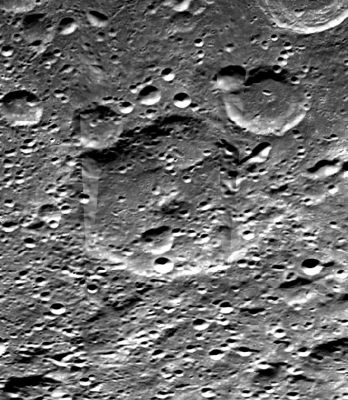
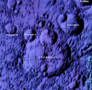
Crommelin lies some 800 kilometres south-east from the main central region of the [/South%20Pole-Aitken%20Basin South-Pole Aitken Basin] -- a 2500 kilometre-wide basin of the [/Stratigraphy pre-Nectarian] period (~ 4.6 to 3.92 bn years). The crater is barely perceptible amongst an amalgamation of impact craters of all sizes (most particularly of small craterlets) that have shapened nearly most of Crommelin's outer ramparts, its well-worn rim, and interior floor. Several of the major, younger impact events on the outer northern sectors of the crater, for example, Crommelin C to its north-east and Crommelin X to its north-west (and the smalller craters in between) have imparted material onto the floor of Crommelin. It looks like this material, too, has subsequently been covered over by later material from another series of impact events whose craters (craterlets) dominate the whole of the floor's history; making it hard to ditinguish features like the collapsed wall south-east of Crommelin X, the southern part of the large crater within the northern sector of Crommelin, and, of course, the central peak now barely recognisable. But where have all these young, destruct-like craters (craterlets) come from? Looking at both the inside and outside regions of Crommelin as a whole, perhaps we're looking at secondaries and tertiaries produced from the main impact-basin events nearby, like those, for example, of the [/Mendel-Rydberg%20Basin Mendel-Rydberg Basin] some 700 km east-north-east of the crater, or the [/Mare%20Orientale Orientale Basin] some 2000 km away in a north-easterly direction? Probably, a combination of both (and others in the region) is responsible, however, from the freshness of most of the craters (craterlets) seen in the region, not to mention the radial, chain direction of some, the most likely candidate is Orientale. - JohnMoore2 JohnMoore2
Description: Wikipedia
Additional Information
Nomenclature
Andrew Claude De La Cherois; British astronomer (1865-1939).
LPOD Articles
Bibliography
This page has been edited 1 times. The last modification was made by - tychocrater tychocrater on Jun 13, 2009 3:24 pm - afx3u2

