Lacus Oblivionis
Contents
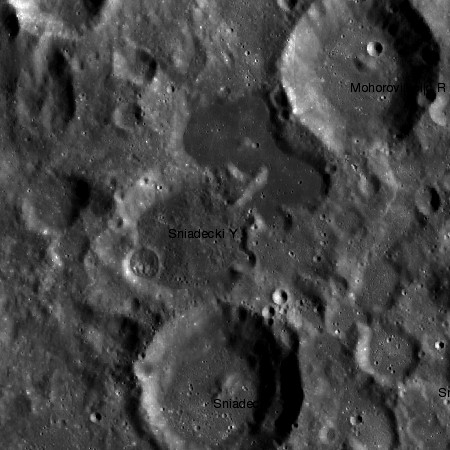
Lacus Oblivionis between Mohorovicic R and Sniadecki Y
| Lat: 21.0°S, Long: 168.0°W, Diam: 50 km, Depth: km, Rükl: (farside) |


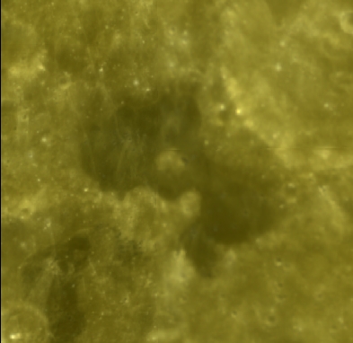
left: LROC
right:Clementine UV-VIS Multispectral Mosaic. Lacus Oblivionis is the dark area to at center. The dark area in the lower left is on the floor of 35-km diameter Sniadecki Y. In the upper right, the much lighter floor of 42-km Mohorovicic R is partially visible.
Images
LPOD Photo Gallery Lunar Orbiter Images Apollo Images
- AS17-151-23191, AS17-151-23192, and AS17-151-23193 show Lacus Oblivionis in photos labeled "north of Sniadecki". Note: these links permit downloading the images in a higher-than-normal Print Resolution too!
- Apollo 17's orbital ITEK-panoramic camera made wonderful STEREO close ups of Lacus Oblivionis. These stereo pairs are: AS17-P-1628 / AS17-P-1633 (the eastern part of Lacus Oblivionis), and: AS17-P-1630 / AS17-P-1635 (the western part of Lacus Oblivionis).
- Lacus Oblivionis and nearby Sniadecki were also photographed during the mission of ZOND 8 in 1970, see: Frame 49 (right of the image's central cross), on Don P. Mitchell's Soviet Moon Images page. North is leftward.
- Sunset at Lacus Oblivionis: Apollo 17's orbital mapping/metric Fairchild-camera frame AS17-M-0328 (Lacus Oblivionis is the grey flat-floored formation at left of the frame's centre).
- Research Apollo 17 and Zond 8 photographs: Danny Caes
Maps
(LAC zone 105A4) USGS Digital Atlas PDF
Description
Description: Wikipedia
Additional Information
Nomenclature
- Name means: "Lake of Forgetfulness".
- The name was approved by the IAU in 1976 (IAU Transactions XVIB).
LPOD Articles
Bibliography