Watts
Contents
Watts
(formerly [/Taruntius Taruntius] D)
|
Lat: 8.83°N, Long: 46.3°E, Diam: 15.55 km, Depth: 0.97 km, [/R%C3%BCkl%2037 Rükl: 37] |
Table of Contents
[#Watts Watts]
[#Watts-Images Images]
[#Watts-Maps Maps]
[#Watts-Description Description]
[#Watts-Description-Wikipedia Wikipedia]
[#Watts-Additional Information Additional Information]
[#Watts-Nomenclature Nomenclature]
[#Watts-LPOD Articles LPOD Articles]
[#Watts-Bibliography Bibliography]

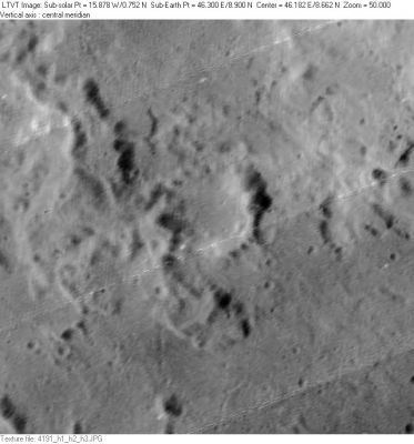
LO-IV-191H Watts is the small formation in the center.
Images
LPOD Photo Gallery Lunar Orbiter Images Apollo Images
Maps
([/LAC%20zone LAC zone] 61B3) LAC map Geologic map LTO map
Description
Wikipedia
Additional Information
- IAU page: Watts
- Depth data from [/Kurt%20Fisher%20crater%20depths Kurt Fisher database]
- Westfall, 2000: 0.97 km
- Viscardy, 1985: 0.9 km
Nomenclature
- Named for Chester Burleigh Watts (1889-1971), an American astronomer who spent many years preparing detailed charts of the topography of the Moon's [/limb limb] (as seen from Earth).
- This replacement name for a formerly [/lettered%20crater lettered crater] was introduced on LTO-61B3 (for which it served as the chart title). It appears in the cumulative list of approved names in [/IAU%20Transactions%20XVB IAU Transactions XVB] (1973). Since it does not appear in any prior [/IAU%20Transactions IAU Transactions], it was probably approved at the 1973 meeting. Biographical information was unofficially reported in [/Ashbrook%2C%201974 Ashbrook, 1974]. - JimMosher JimMosher
LPOD Articles
Bibliography
[/Alphabetical%20Index Named Featues] -- Prev: [/Watt Watt] -- Next: [/Webb Webb]
This page has been edited 1 times. The last modification was made by - tychocrater tychocrater on Jun 13, 2009 3:24 pm - afx3u3