Kearons
Contents
Kearons
| Lat: 11.4°S, Long: 112.6°W, Diam: 23 km, Depth: km, Rükl: (farside) |
Table of Contents
[#Kearons Kearons]
[#Kearons-Images Images]
[#Kearons-Maps Maps]
[#Kearons-Description Description]
[#Kearons-Description: Wikipedia Description: Wikipedia]
[#Kearons-Additional Information Additional Information]
[#Kearons-Nomenclature Nomenclature]
[#Kearons-LPOD Articles LPOD Articles]
[#Kearons-Bibliography Bibliography]


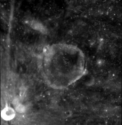
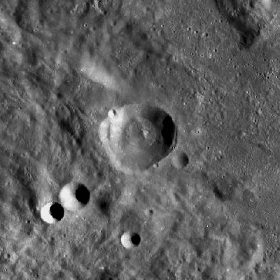
left: Clementine . right: LROC . Kearons is located inmediately outside northwest Orientale basin rim .
Images
LPOD Photo Gallery Lunar Orbiter Images Apollo Images
Maps
(LAC zone 89C2) USGS Digital Atlas PDF
Description
Description: Wikipedia
Additional Information
Nomenclature
- Named for William M. Kearons (1878-1948), an American astronomer.
- Kearons was among the long list of IAU-approved farside lunar feature names published in Menzel, 1971. According to the citation supplied by Menzel (himself a famous American solar astronomer), Kearons was "a minister and amateur observer of sunspots over many years; noted esp. for his fine photographs of sunspots."
- Kearons was one of two features (the other being Lewis) that Antonín Rükl omitted from his 1972 Maps of lunar hemispheres (illustrating the new IAU nomenclature) because he was unable to find a likely feature at the stated position. - JimMosher JimMosher
- On the farside map of Hallwag, the name Kearons was printed as Kearsons. - DannyCaes DannyCaes Oct 20, 2010
LPOD Articles
Bibliography
- Kearons, William M. 1937. Photograph of Sunspots. Popular Astronomy, Vol. 45, p. 254.
- Biographical notes:
This page has been edited 1 times. The last modification was made by - tychocrater tychocrater on Jun 13, 2009 3:24 pm - afx3u2