Difference between revisions of "Lara"
| Line 11: | Line 11: | ||
''([[LAC%20zone|LAC zone]] 43D1)'' [http://www.lpi.usra.edu/resources/mapcatalog/LAC/lac43/ LAC map] [http://www.lpi.usra.edu/resources/mapcatalog/usgs/I799/ Geologic map] [http://www.lpi.usra.edu/resources/mapcatalog/LTO/lto43d1_2/ LTO map]<br /> <br /> | ''([[LAC%20zone|LAC zone]] 43D1)'' [http://www.lpi.usra.edu/resources/mapcatalog/LAC/lac43/ LAC map] [http://www.lpi.usra.edu/resources/mapcatalog/usgs/I799/ Geologic map] [http://www.lpi.usra.edu/resources/mapcatalog/LTO/lto43d1_2/ LTO map]<br /> <br /> | ||
==Description== | ==Description== | ||
| − | The [[Landing% | + | The [[Landing%20site%20name|Landing Site Name]] "Lara" is plotted on [http://www.lpi.usra.edu/resources/mapcatalog/topophoto/43D1S1/ Topophotomap 43D1/S1] and [http://www.lpi.usra.edu/resources/mapcatalog/LPST/43d1s2/ Site Traverses chart 43D1S2].<br /> <br /> |
==Description: Wikipedia== | ==Description: Wikipedia== | ||
[https://en.wikipedia.org/wiki/Lara_(lunar_crater) Lara]<br /> <br /> | [https://en.wikipedia.org/wiki/Lara_(lunar_crater) Lara]<br /> <br /> | ||
Revision as of 20:10, 18 April 2018
Contents
Lara (Apollo 17 site craterlet name)
| Lat: 20.4°N, Long: 30.5°E, Diam: 0 km, Depth: km, Rükl: 25 |


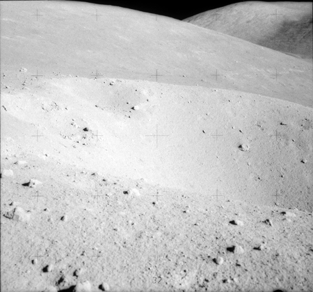
Left: Aerial view from Apollo 17 Site Traverses Chart The bright background is because Lara lies on the Light Mantle formation; Right: View from ground: Apollo Image Atlas.
Images
LPOD Photo Gallery Lunar Orbiter Images Apollo Images from air
Apollo images from ground (Lara is Station 3 on EVA 2): Magazine I (138)
Maps
(LAC zone 43D1) LAC map Geologic map LTO map
Description
The Landing Site Name "Lara" is plotted on Topophotomap 43D1/S1 and Site Traverses chart 43D1S2.
Description: Wikipedia
Additional Information
Nomenclature
- Astronaut-named feature, Apollo 17 site.
- IAU Transactions XVIB identifies this only as a "girl's name", but Apollo 17 astronaut Harrison Schmitt recalled this crater was "named for Boris Pasternak's heroine from Dr. Zhivago and honoring all the inspiring women of history, known and unknown".
- A sub-region in (or on) the Light Mantle (west of Lara) seems to have been called Roman Steppe. Another section of the Light Mantle seems to have been called Hole-In-The-Wall. North of Lara is a crater (or another surface formation?) which was known as Stonewall. And immediately east of Lara runs the Lee Scarp (source: APOLLO 17 Preliminary Science Report).- DannyCaes May 6, 2014
LPOD Articles
Bibliography
David M. Harland: EXPLORING THE MOON, the Apollo expeditions.
  Eric M. Jones: APOLLO LUNAR SURFACE JOURNAL (ALSJ).