Sinus Roris
Contents
Sinus Roris
|
Lat: 54.0°N, Long: 56.6°W, Diam: 202 km, Depth: km, [/R%C3%BCkl%201 Rükl: 1] |
Table of Contents
[#Sinus Roris Sinus Roris]
[#Sinus Roris-Images Images]
[#Sinus Roris-Maps Maps]
[#Sinus Roris-Description Description]
[#Sinus Roris-Description: Neison, 1876 Description: Neison, 1876]
[#Sinus Roris-Description: Wikipedia Description: Wikipedia]
[#Sinus Roris-Additional Information Additional Information]
[#Sinus Roris-Nomenclature Nomenclature]
[#Sinus Roris-LPOD Articles LPOD Articles]
[#Sinus Roris-Bibliography Bibliography]

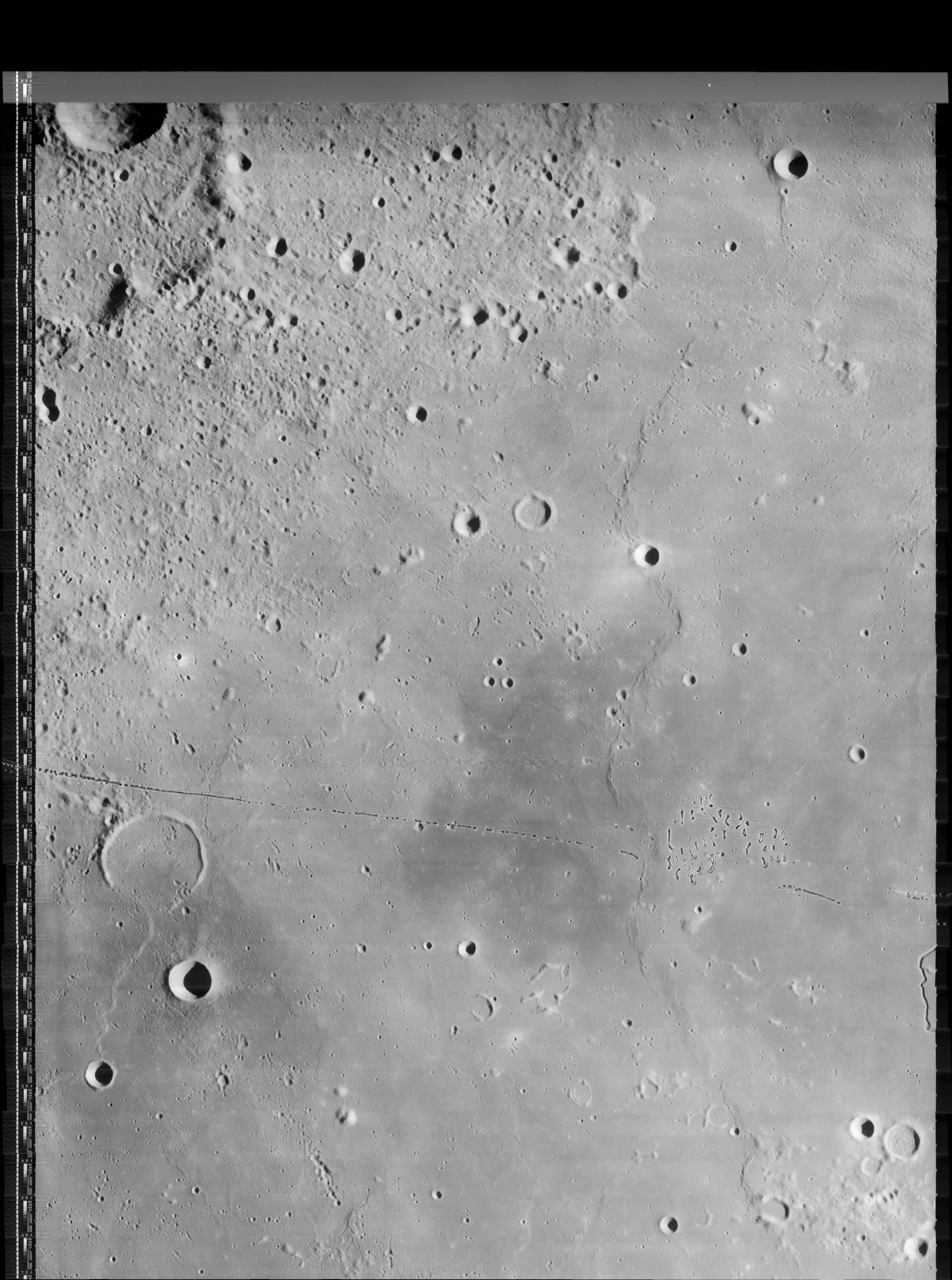
LO-IV-188M The white circle illustrates the current [/IAU IAU] definition of Sinus Roris. Originally the name seems to have meant most of [/Oceanus%20Procellarum Oceanus Procellarum] north of [/Mons%20R%C3%BCmker Mons Rümker], but ending at [/Harpalus Harpalus], for the dark [/mare mare] region beyond that (upper right) is now regarded as part of [/Mare%20Frigoris Mare Frigoris].
Images
LPOD Photo Gallery Lunar Orbiter Images
- Although there's nothing Sinus Roris-like mentioned in the LPI's Apollo Images Search, there are few orbital Hasselblads of Sinus Roris' southern part in Apollo 15's Hasselblad magazine 93-P (photographs AS15-93-12730 to 12734, looking north). Research: Danny Caes
- Curious twisted arc-shapes in Sinus Roris. Take a look at the lower part of Lunar Orbiter 4's frame LOIV-170-H3. This kind of twisted arc-shapes is also noticeable at Mare Frigoris, between La Condamine and J.Herschel. - DannyCaes DannyCaes Nov 10, 2009
Maps
([/LAC%20zone LAC zone] 10C2) USGS Digital Atlas PDF
Description
Description: [/Neison%2C%201876 Neison, 1876]
([/IAU%20Directions IAU Directions]) SINUS RORIS - The great northern bay of the [/Oceanus%20Procellarum Oceanus Procellarum], bordered on the east by the highlands of the [/Sinus%20Iridum Sinus Iridum], on the north by the elevated region between [/Harpalus Harpalus] and [/Oenopides Oenopides], and on the west by the bright ridge extending between [/Oenopides Oenopides] and [/Gerard Gerard]. The northern section of the floor is the brightest and is traversed by a number of grey ridges.
Description: Wikipedia
Additional Information
Nomenclature
- Sinus Roris is Latin for "Bay of Dew".
- According to [/Whitaker Whitaker] (p. 216), this name was introduced on [/Riccioli Riccioli]'s map. However, Riccioli used the name to refer to the dark mare patches on either side of the crater [/Harpalus Harpalus] as seen in this zero-libration Earth-based view adapted from the [/Consolidated%20Lunar%20Atlas Consolidated Lunar Atlas] (note: for orientation, the word "Riccioli" is printed over [/Sinus%20Iridum Sinus Iridum] and the prominent central-peaked crater at the top is [/Pythagoras Pythagoras] with [/Babbage Babbage] below it):

- Later cartographers extended Riccioli's definition of [/Mare%20Frigoris Mare Frigoris] to include the dark mare region on the east of [/Harpalus Harpalus]. This pushed Sinus Roris to the west and south, where it assumed an increasingly ill-defined status.
- The name as adopted into the original [/IAU%20nomenclature IAU nomenclature] of [/Blagg%20and%20M%C3%BCller Blagg and Müller] (1935), presumably refers to the large area described by Neison (above), which incorporates most of [/Oceanus%20Procellarum Oceanus Procellarum] north of [/Mons%20R%C3%BCmker Mons Rümker].
- The name as printed on the [/System%20of%20Lunar%20Craters System of Lunar Craters] [/Quad%20Maps Quad Maps] seems to continue this tradition, with the name printed in [/Oceanus%20Procellarum Oceanus Procellarum] roughly midway between [/Markov Markov] and [/Mairan Mairan].
- For unknown reasons the [/IAU%20Planetary%20Gazetteer IAU Planetary Gazetteer] adopted a position and diameter (quoted in the title line of this page) that correspond to a much more restricted area, which is now, by default, the official definition. On the highland side it is bounded roughly by the craters [/Markov Markov], [/Oenopides Oenopides], [/Babbage Babbage] and [/South South]; and on the mare side it extends only to about the location of [/Harpalus Harpalus] E. Most of the area within this official circle is rough bright material, rather than dark mare.
LPOD Articles
Bibliography
This page has been edited 1 times. The last modification was made by - tychocrater tychocrater on Jun 13, 2009 3:24 pm - afx3u2