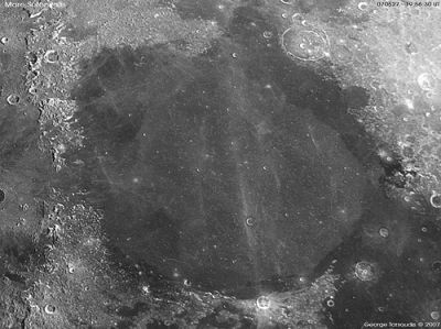
Serenitatis, Mare
Mare Serenitatis
| Lat: 28.0°N, Long: 17.5°E, Diam: 707 km, Depth: 2.5 km, Rükl: 23 |

George Tarsoudis
Images
LPOD|Photo Gallery images Lunar Orbiter Images Apollo Images
Maps ([/LAC%20zone LAC zone] 42A3)
LAC map Geologic map LM map LTO map
Description
Description: Wikipedia
Mare Serenitatis
Additional Information
Depth data from [/Kurt%20Fisher%20crater%20depths Kurt Fisher database]
- Pike, 1976: 2.5 km
Named for
"Sea of Serenity".
LPOD Articles
Serenitatis in Black and White and Gray
Serenitatis Diameter Sequence
Crumpled Sheets of Lava
Make Your Own Atlas
Bibliography
This page has been edited 1 times. The last modification was made by - tychocrater tychocrater on Jun 13, 2009 3:24 pm - afx2