Orthographic Atlas of the Moon
Contents
Arthur and Whitaker: Orthographic Atlas of the Moon (1960)
(glossary entry)Table of Contents
[#Arthur and Whitaker: Orthographic Atlas of the Moon (1960) Arthur and Whitaker: Orthographic Atlas of the Moon (1960)]
[#Arthur and Whitaker: Orthographic Atlas of the Moon (1960)-Description Description]
[#Arthur and Whitaker: Orthographic Atlas of the Moon (1960)-Additional Information Additional Information]
[#Arthur and Whitaker: Orthographic Atlas of the Moon (1960)-LPOD Articles LPOD Articles]
[#Arthur and Whitaker: Orthographic Atlas of the Moon (1960)-Bibliography Bibliography]
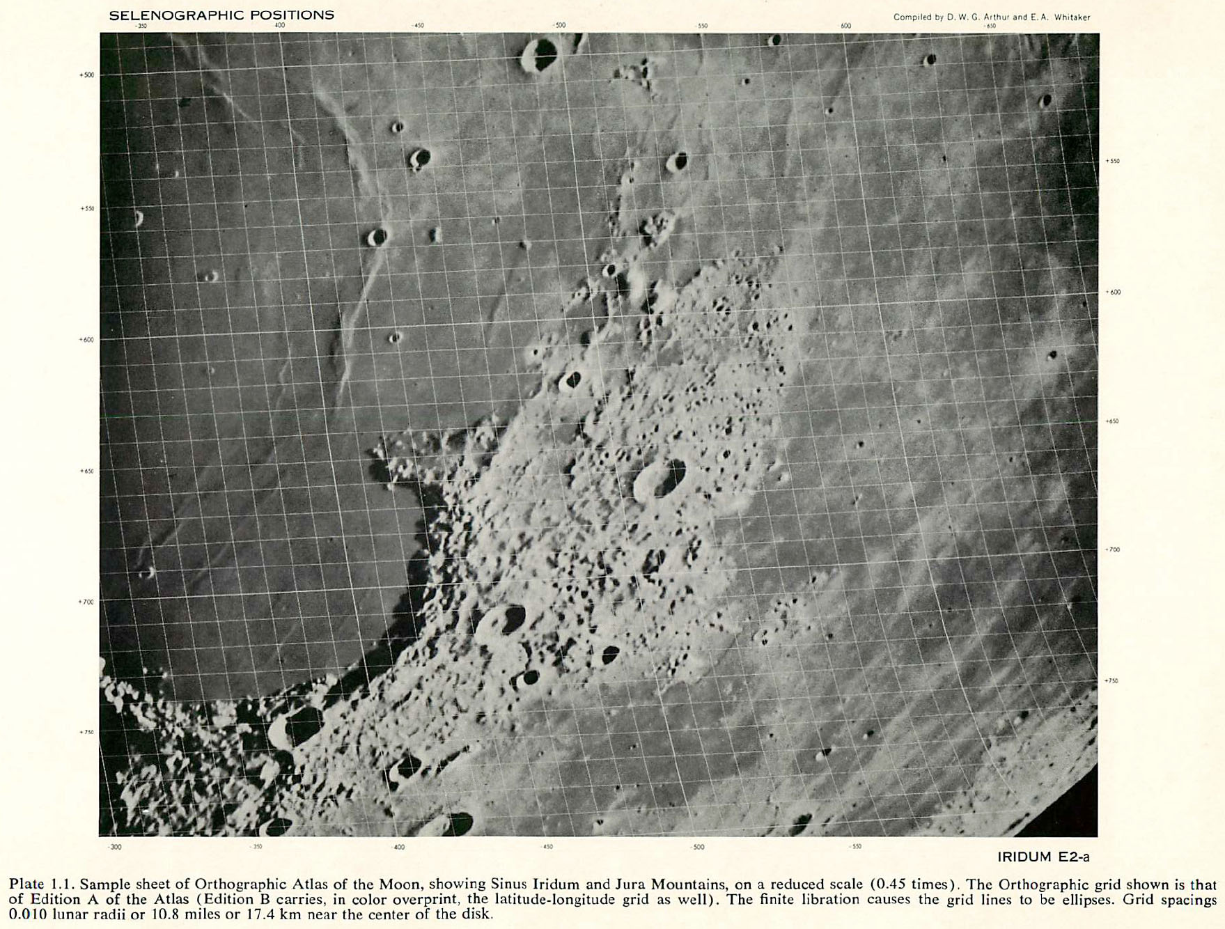
Description
As the full title explains, this is the first of four supplements to the LPL's original Photographic Lunar Atlas.
Additional Information
- This work consists of the best photos for each of the 44 fields in the earlier atlas overprinted with the rectangular xi-eta grid (adjusted to the correct librations for the photo) at a spacing of 0.01 lunar radius, and in the "Air Force" edition with colored lines of latitude and longitude at intervals of 2°. The work was primarily preformed by the LPL, but the ACIC assisted in computing the grids.
 <-- prototype image shown in Communications of the Lunar and Planetary Laboratory #1 (click for larger view)

LPOD Articles
Un atlas orthographique - the English version of this LPOD has diappeared!
Bibliography
- Arthur, D. W. G.; and Whitaker, E. A. (compilers). 1960. Orthographic Atlas of the Moon-Supplement Number One to the Photographic Lunar Atlas. NASA NsG-37-60 and Contract AF-19(604)-7260, Aeronaut. Chart Inform. Center.
This page has been edited 1 times. The last modification was made by - tychocrater tychocrater on Jun 13, 2009 3:24 pm - mgx2