Fauth
Contents
Fauth
|
Lat: 6.21°N, Long: 20.17°W, Diam: 11.94 km, Depth: 1.97 km, [/R%C3%BCkl%2031 Rükl: 31] |
Table of Contents
[#Fauth Fauth]
[#Fauth-Images Images]
[#Fauth-Maps Maps]
[#Fauth-Description Description]
[#Fauth-Description-Wikipedia Wikipedia]
[#Fauth-Additional Information Additional Information]
[#Fauth-Nomenclature Nomenclature]
[#Fauth-LPOD Articles LPOD Articles]
[#Fauth-Bibliography Bibliography]

Eric Soucy, [/Copernicus Copernicus] and the region south with craters Fauth (tiny double below Copernicus), [/Reinhold Reinhold] and [/Lansberg Lansberg]
Images
LPOD Photo Gallery Lunar Orbiter Images Apollo Images
- AS12-47-6875 and the almost identical looking AS12-47-6876 are two of the most frequently reproduced orbital Hasselblads of Fauth (between [/Copernicus Copernicus] near the horizon and [/Reinhold Reinhold] in the foreground). On these two orbital Hasselblads, Fauth is noticeable a little bit to the right of [/Copernicus Copernicus]. Research: Danny Caes.
- AS12-52-7739 shows Fauth (foreground) and [/Copernicus Copernicus] between Fauth and the [/Montes%20Carpatus Montes Carpatus] at the horizon. Research: Danny Caes.
Maps
([/LAC%20zone LAC zone] 58D2) LAC map Geologic map AIC map
Description
Wikipedia
Additional Information
- IAU page: Fauth
- Depth data from [/Kurt%20Fisher%20crater%20depths Kurt Fisher database]
- Arthur, 1974: 1.97 km
- Westfall, 2000: 1.97 km
- Viscardy, 1985: 1.96 km
- Cherrington, 1969: 1.85 km
Nomenclature
- Named for Philipp Johann Heinrich Fauth (1867-1941), a German elementary school teacher and amateur selenographer who wrote two major Moon books (The Moon in Modern Astronomyand Unser Mond) and created the last large hand drawn map. Examples of Fauth's maps can be found as Figures 105 and 106 in [/Whitaker Whitaker]. They are admired for the richness of detail obtained using visual observations through a 15-1/2 inch apochromatic refractor. Many regard them as unsurpassed. [/Whitaker Whitaker] (p. 168), regarded him as "an excellent cartographer." More about Fauth, his maps, and his advocacy of the lunatic Hörbiger theory of lunar glaciation can be found in Ashbrook (1965, below). Ashbrook regarded Fauth as "perhaps the most capable and versatile of all active visual observers of the Moon between about 1890 and 1940" and Unser Mond (1936) as "the best of all observing books to the moon's surface." - JimMosher JimMosher
- Named by [/M%C3%BCller Karl Müller] in [/Blagg%20and%20M%C3%BCller Named Lunar Formations] in 1935 ([/Whitaker Whitaker], p 229).
- [/Names%20of%20J.P.H.Fauth List] of Fauth's additions to lunar nomenclature.
LPOD Articles
Bibliography
- Fauth, P. 1909. The moon in modern astronomy: summary of twenty years selenographic work. Translated by Joseph McCabe, with Introduction by J. Ellard Gore. D. Van Nostrand Company, New York. (Google books)
- Fauth, Ph. 1916. 25 Jahre Planetenforschung: this fourth volume of publications from Fauth's private observatory is devoted primarily to his observations of the planets and Sun, but Section II.A describes his lunar studies, including an illustration of the [/Hyginus Hyginus] region. A scanned copy of this 50 page work can be found, at least temporarily, in Peter Abraham's on-line collection of Fauth papers
- Fauth, Ph. 1936. Unser Mond--wie Man ihn lesen Sollte--neues Handbuch für forscher nach Erfahrungen aus 52 Jahren Beobachtung. Publikation VII seiner Sternwarte. Breslau: Dr. H. Eschenhagen.
- [/Whitaker Whitaker] says of the 34-inch diameter map in six sections that accompanies this book that it "uses a novel type of representation for the topographic features that is aesthetically quite pleasing."
- A color image of the map's title page and a portion of one section is reproduced in the September 5, 2007, LPOD. The full six map set, scanned in 12 pieces, can be found, at least temporarily, in Peter Abraham's on-line collection of Fauth papers (mostly collected from the NASA ADS server).
- Fauth, H. 1959. "Philipp Fauth and the Moon." Sky and Telescope Vol. 19, pp. 20-24. This extended biographical sketch by Fauth's son includes photos of three of his observatories, and examples of his cartography, including a 1:200,000 scale map of [/Copernicus Copernicus] prepared in July, 1932.
- A scanned copy of this article, along with several others relevant to Fauth's Moon mapping efforts, can be found in the aforementioned collection Fauth papers.
- Staubermann, K. 2000. Book Review: Philipp Fauth : Leben und Werk. Journal for the history of astronomy, vol. 31, part 1, p. 86
- Fauth atlas notes from astronomical historian [/Robert%20Garfinkle Robert Garfinkle]:
- Fauth, Philipp. Mondatlas (“Moon Atlas”). Bremen, Germany: Olbers-Gesellschaft, 1964. The atlas portfolio includes the explanatory pamphlet Erläuterungen Zum Fauth ’schen Mondatlas (“Explanations for Fauth’s Moon Atlas.”) by PhilippFauth, 1964. Also included is Mondcarte der Ramen und Orter, 1936. The Moon is in 6 sections with lines of orthographic coordinates. Main charts of the atlas lack lines of coordinates.
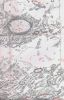 Sample of the [/Plato Plato] map section scanned by [/Robert%20Garfinkle Robert Garfinkle]
- Further information from Ashbrook (1965): "Physically, the atlas consists of a cardboard carton about 18 by 11 by 1 inches, containing 22 loose sheets that each unfold to about 33 by 32 inches. In the carton are also a 38-page explanatory booklet in German and a copy of Fauth's very useful 1:4,000,000 map of 1936, originally published in Unser Mond. Unlike early Fauth maps, where vertical relief is indicated by hachures, the large atlas uses contour lines to represent craters, mountains, ridges and other elevations and depressions. Not based on actual measurements of lunar topography, these contours are fictions intended to suggest Fauth's visual impressions. ... Names of features are printed in red. An inspection of Sheet 1 shows two misspellings... Sometimes names proposed by H. P. Wilkins are given instead of the IAU names ... Some confusion results from frequent departures from the handy IAU rule of craterlets with compound designations like Mösting B, whereby the letter B is placed on the side of the craterlet facing Mösting itself."
- The large maps, in 22 sections at a scale of 1:1,000,000 (5 finished by Fauth and 17 completed by his son Hermann), are reportedly available on Andreas Phillip's Atlas Lunarum DVD. His website includes an example of Fauth's drawing style.
- Fauth, Herman. Übersichtskarte Des Mondes (“General Charts of the Moon”). Bremen: Olbers-Gesellschaft, 1966. Portfolio of Philipp Fauth’s Moon map in 6 sections and is the same maps as in the 1964 set.
- Fauth, Philipp. Mondatlas (“Moon Atlas”). Bremen, Germany: Olbers-Gesellschaft, 1964. The atlas portfolio includes the explanatory pamphlet Erläuterungen Zum Fauth ’schen Mondatlas (“Explanations for Fauth’s Moon Atlas.”) by PhilippFauth, 1964. Also included is Mondcarte der Ramen und Orter, 1936. The Moon is in 6 sections with lines of orthographic coordinates. Main charts of the atlas lack lines of coordinates.

- Ashbrook, J. 1965. "The Fauth Moon Atlas." Sky and Telescope. Vol. 30, No. 3 (October issue), pp. 202-210. (adapted as Chapter 52 in [/Ashbrook%2C%201984 Ashbrook, 1984] -- the adaptation includes four map excerpts not present in the original [such as the section with Clavius, below], but does not reproduce the two it contained)
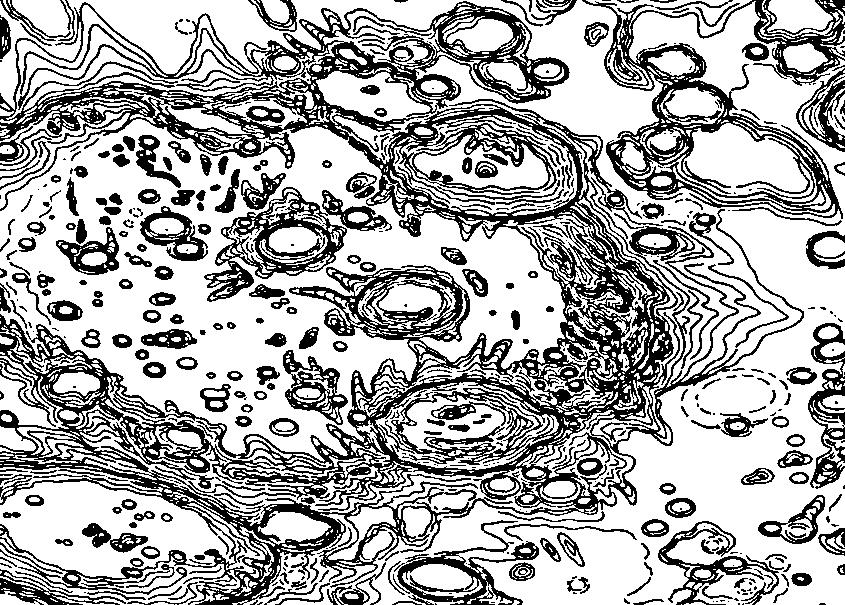 <-- [/Clavius Clavius] in Fauth Mondatlas (turned north up, click to view)
- Presumably to Fauth the "contour" lines were a convenient way to consolidate the way he saw shadows cast with various lightings, without having to render any particular shading geometry. The heavy lines (not as clear in this scan as in the "original") appear to mark transitions between up and down slopes. The level of detail, but not the accuracy, compares favorably to the [/DMA ACIC]'s LAC-126, which is at the same scale, but shown in a more nearly overhead view.

[/Alphabetical%20Index Named Featues] -- Prev: [/Faustini Faustini] -- Next: [/Faye Faye]
This page has been edited 1 times. The last modification was made by - tychocrater tychocrater on Jun 13, 2009 3:24 pm - afx3u3