Dorsa Barlow
Contents
Dorsa Barlow
|
Lat: 15.0°N, Long: 31.0°E, Length: 120 km, Height: km, Rükl: 25 |
Table of Contents
[#Dorsa Barlow Dorsa Barlow]
[#Dorsa Barlow-Images Images]
[#Dorsa Barlow-Maps Maps]
[#Dorsa Barlow-Description Description]
[#Dorsa Barlow-Description: Wikipedia Description: Wikipedia]
[#Dorsa Barlow-Additional Information Additional Information]
[#Dorsa Barlow-Nomenclature Nomenclature]
[#Dorsa Barlow-LPOD Articles LPOD Articles]
[#Dorsa Barlow-Bibliography Bibliography]

IV-078-H2
Images
LPOD Photo Gallery Lunar Orbiter Images Apollo Images
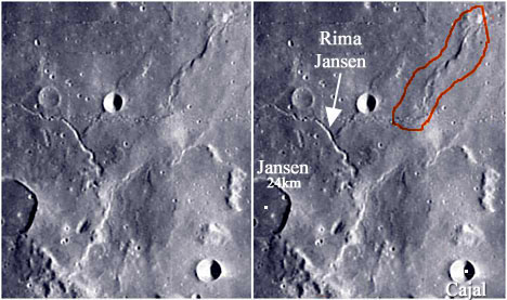
- An interesting oblique north-looking close up of Dorsa Barlow (and environs, during local sunrise) is Apollo 8's breathtaking Hasselblad-photograph AS8-13-2347. The bowl-shaped crater in the foreground is Cajal (Jansen F). The large crater in the background is Vitruvius. The mountainous region near and at the horizon is the Montes Taurus. A magnificent photograph!
Research: Danny Caes
HiRes-scan of Apollo 8 photograph: David Woods and Frank O'Brien (Apollo 8 Flight Journal).
Maps
(LAC zone 61A1) LAC map Geologic map LTO map
Description
Description: Wikipedia
Additional Information
Nomenclature
William; British crystallographer (1845-1934).
LPOD Articles
Bibliography
This page has been edited 1 times. The last modification was made by - tychocrater tychocrater on Jun 13, 2009 3:24 pm - afx3u2