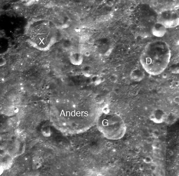
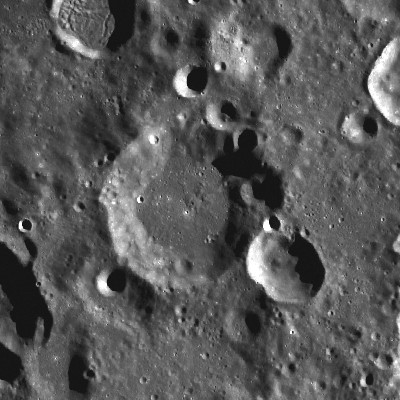
Anders
Contents
Anders
| Lat: 41.3°S, Long: 142.9°W, Diam: 40 km, Depth: km, Rükl: (farside) |
Table of Contents
[#Anders Anders]
[#Anders-Images Images]
[#Anders-Maps Maps]
[#Anders-Description Description]
[#Anders-Description: Wikipedia Description: Wikipedia]
[#Anders-Additional Information Additional Information]
[#Anders-Nomenclature Nomenclature]
[#Anders-LPOD Articles LPOD Articles]
[#Anders-Bibliography Bibliography]


left: Clementine . right: LROC
Images
LPOD Photo Gallery Lunar Orbiter Images Apollo Images
Maps
([/LAC%20zone LAC zone] 121C1) USGS Digital Atlas PDF
Description
Description: Wikipedia
Additional Information
Nomenclature
- Named for William Alison Anders (October 17, 1933-living), an American astronaut who flew on Apollo 8. In December 1968 Anders took a photograph of Earthrise that has become one of the most celebrated of the US space program. This is one of the few lunar features that was named for a [/Nomenclature%20Zoo#Living_People living person].
- This name is one of twelve honoring living U.S. and Soviet astronauts and cosmonauts approved by the [/IAU%20Transactions%20XIVB#Session_2 IAU] in 1970 and published in [/Menzel%2C%201971#4 Menzel, 1971].
LPOD Articles
Bibliography
-William Anders; Apollo 8:
- A MOST FANTASTIC VOYAGE; the story of Apollo 8's rendez-vous with the moon (by Lt. Gen. Sam C. Phillips), NATIONAL GEOGRAPHIC, May 1969.
This page has been edited 1 times. The last modification was made by - tychocrater tychocrater on Jun 13, 2009 3:24 pm - afx3u2