Pontécoulant
Contents
Pontécoulant
|
Lat: 58.7°S, Long: 66.0°E, Diam: 91 km, Depth: 5.6 km, Rükl 76, Nectarian |
Table of Contents
[#Pontécoulant Pontécoulant]
[#Pontécoulant-Images Images]
[#Pontécoulant-Maps Maps]
[#Pontécoulant-Description Description]
[#Pontécoulant-Description: Elger Description: Elger]
[#Pontécoulant-Description: Wikipedia Description: Wikipedia]
[#Pontécoulant-Additional Information Additional Information]
[#Pontécoulant-Nomenclature Nomenclature]
[#Pontécoulant-LPOD Articles LPOD Articles]
[#Pontécoulant-Bibliography Bibliography]


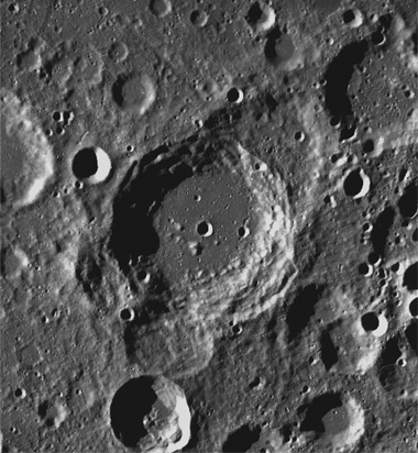
Left: LROC (aerial view)
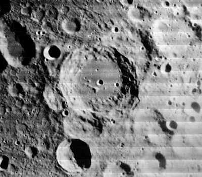
Right: LO-IV-044 H3
Images
LPOD Photo Gallery Lunar Orbiter Images Apollo Images
Maps
(LAC zone 128C2) USGS Digital Atlas PDF
Description
Description: Elger
(IAU Directions) PONTECOULANT.--A great irregular walled plain, about 100 miles in length, near the S.E. limb, with a border rising in places to a height of 6,000 feet above the floor.
Description: Wikipedia
Additional Information
- Depth data from Kurt Fisher database
- Westfall, 2000: 5.6 km
- Satellite crater Pontécoulant J is radar bright at 70 cm.
Nomenclature
Philippe Gustave Doulcet, Comte De Pontécoulant (1795-1874) was a French mathematician and astronomer. In 1829 he used the mathematical methods of Poisson and Lagrange to successfully predicted the return of Halley's comet with good precision. His prediction of the perihelion passage was correct to within two days.
LPOD Articles
Bibliography
This page has been edited 1 times. The last modification was made by - tychocrater tychocrater on Jun 13, 2009 3:24 pm - afx3u2