Chernyshev
Contents
Chernyshev
|
Lat: 47.3°N, Long: 174.2°E, Diam: 58 km, Depth: km, Rükl: (farside), Nectarian | |
Table of Contents
[#Chernyshev Chernyshev]
[#Chernyshev-Images Images]
[#Chernyshev-Maps Maps]
[#Chernyshev-Description Description]
[#Chernyshev-Description: Wikipedia Description: Wikipedia]
[#Chernyshev-Additional Information Additional Information]
[#Chernyshev-Nomenclature Nomenclature]
[#Chernyshev-LPOD Articles LPOD Articles]
[#Chernyshev-Bibliography Bibliography]
Images
LPOD Photo Gallery Lunar Orbiter Images Note 1 Apollo Images
Maps
(LAC zone 32B2) USGS Digital Atlas PDF
Description
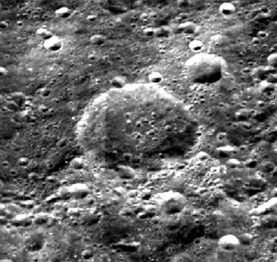
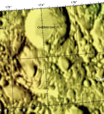
On first glance at Chernyshev, one would find it hard to define any apppearance of a rim all around as most regions here have either been obliterated by small impact craters, or accumulation of several impact events particualrly noticed in the southern sectors. As a result, the rim looks well worn down, and most of its history lies in these impacts that occurred later. No signs of terracing is seen, but rather a gradual degree of sloped, eroded material onto the floor - particularly in the southern sector where relatively larger impacts have imparted their ejecta into the floor producing a series of hill and mountains. No peak exists at the central regions of the floor for such a crater, but rather a litter of similarly-sized craters each approximately 5 km in diameter that may not have had anything to do with disintegration or obliteration of a once-existant peak. - JohnMoore2 JohnMoore2
Description: Wikipedia
Additional Information
Note 1: The Lunar Orbiter link containing V-030-H2 does not have any image-reference to Chernyshev but rather to Chebyshev; where confusion has posssibly occurred between the two.
Nomenclature
Nikolaj G.; Soviet rocketry engineer (1906-1963).
LPOD Articles
Bibliography
This page has been edited 1 times. The last modification was made by - tychocrater tychocrater on Jun 13, 2009 3:24 pm - afx3u2//

