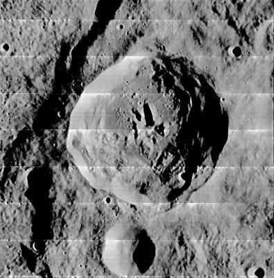
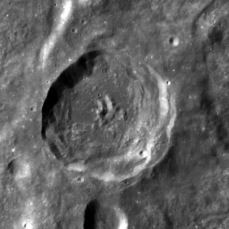
Eichstadt
Contents
Eichstadt
|
Lat: 22.6°S, Long: 78.3°W, Diam: 49 km, Depth: 4.52 km, [/R%C3%BCkl%2050 Rükl: 50] |
Table of Contents


left: LOIV-181-h1 . right: LROC . [/Montes%20Cordillera Montes Cordillera ]are inmediately adjacent to Eichstadt west rim.
Images
LPOD Photo Gallery Lunar Orbiter Images
Maps
([/LAC%20zone LAC zone] 91B4) USGS Digital Atlas PDF
Description
Description: Elger
([/IAU%20Directions IAU Directions]) EICHSTADT.--A ring-plain, 32 miles in diameter, near the W. limb, S. of [/Rocca Rocca]. It is the largest and most southerly of three nearly circular enclosures, without central mountains or any other details of interest. On the E. lies a great walled-plain with a very irregular border, containing several ring-plains and craters, and a crater-rill. Schmidt has named this formation DARWIN.
Description: Wikipedia
Additional Information
- Depth data from [/Kurt%20Fisher%20crater%20depths Kurt Fisher database]
- Westfall, 2000: 4.52 km
- [/Central%20peak%20composition Central peak composition]: A & GNTA1 ([/Tompkins%20%26%20Pieters%2C%201999 Tompkins & Pieters, 1999])
Nomenclature
Lorentz Eichstadt (1596-1660) was a German mathematician and astronomer.
LPOD Articles
A Bump in the Day (an extraordinary photograph of Eichstadt and environs by Pete Lawrence, interesting to compare with page 151 of Harold Hill's A Portfolio of Lunar Drawings)(see below; Bibliography).- DannyCaes DannyCaes Oct 16, 2008
Bibliography
A Portfolio of Lunar Drawings (Harold Hill), page 151 (the Eichstadt sector of the Mare Orientale region).
This page has been edited 1 times. The last modification was made by - tychocrater tychocrater on Jun 13, 2009 3:24 pm - afx3u2