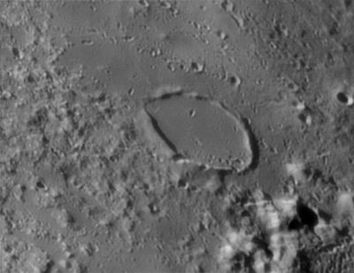
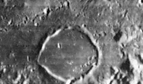
Egede
Contents
[hide]Egede
|
Lat: 48.7°N, Long: 10.6°E, Diam: 37 km, Depth: 0.43 km, [/R%C3%BCkl%205 Rükl: 5] |


Left: François Emond Right: LOIV-103-H3
Table of Contents
Images
LPOD Photo Gallery Lunar Orbiter Images
Egede G, the 3th item in C.A.Wood's list of Concentric Craters (1978) is noticeable near the lower left corner of Lunar Orbiter 4's photograph LOIV-104-h1. The location of Egede G is very near the northeastern end of Vallis Alpes. The proximity of the well-known Vallis Alpes is noticeable on LOIV-110-h3 (near the lower margin of the frame).
Research: Danny Caes
Maps
([/LAC%20zone LAC zone] 13D4) LAC map Geologic map
Description
Description: Elger
([/IAU%20Directions IAU Directions]) EGEDE.--A lozenge-shaped formation, about 18 miles from corner to corner, bounded by walls scarcely more than 400 feet in height. It is consequently only traceable under very oblique illumination.
Description: Wikipedia
Additional Information
- Depth data from [/Kurt%20Fisher%20crater%20depths Kurt Fisher database]
Westfall, 2000: 0.43 km
Viscardy, 1985: 0.42 km
Cherrington, 1969: 0.7 km - Satellite crater Egede A is on the [/ALPO%20list%20of%20bright%20ray%20craters ALPO list of bright ray craters].
- Egede A has a ray pattern with a missing V of rays - this was an oblique impact.
- Egede G is the 3th item in C.A.Wood's list of Concentric Craters (1978).
Nomenclature
- Named for Hans Egede (January 31, 1686,–November 5, 1758), a Norwegian Lutheran missionary, called the Apostle of Greenland.
- According to [/Whitaker Whitaker] (p. 219), this name was introduced by [/M%C3%A4dler Mädler].
LPOD Articles
Bibliography
This page has been edited 1 times. The last modification was made by - tychocrater tychocrater on Jun 13, 2009 3:24 pm - afx3u2