Kugler
Contents
Kugler
| Lat: 53.8°S, Long: 103.7°E, Diam: 65 km, Depth: km, Rükl: (farside) |
Table of Contents
[#Kugler Kugler]
[#Kugler-Images Images]
[#Kugler-Maps Maps]
[#Kugler-Description Description]
[#Kugler-Description: Wikipedia Description: Wikipedia]
[#Kugler-Additional Information Additional Information]
[#Kugler-Nomenclature Nomenclature]
[#Kugler-LPOD Articles LPOD Articles]
[#Kugler-Bibliography Bibliography]


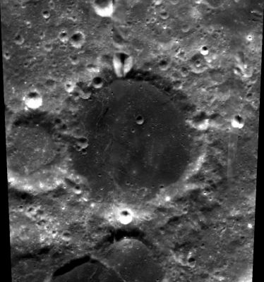
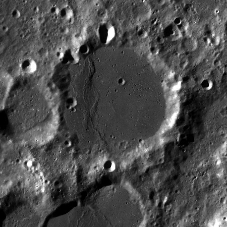
left: Clementine . right: LROC . Kugler at center, note the faulted and beveled western floor . Satellite U is at left border of image and N at bottom border
Images
LPOD Photo Gallery Lunar Orbiter Images Apollo Images
Although not mentioned in the LPI's list of Lunar Orbiter photographs, frame LO4-011-h1 also shows Kugler.
Research: Danny Caes (thanks to Patricio Leon's discovery of nearby Mons Cassegrain).
Maps
(LAC zone 130A4) USGS Digital Atlas PDF
Description
Description: Wikipedia
Additional Information
Nomenclature
- Franz Xaver; German-Babylonian chronologist (1862-1929).
- The pronounced wrinkle ridge on the western part of Kugler's floor is unofficially called Dorsum Kugler by Danny Caes.
LPOD Articles
Bibliography
This page has been edited 1 times. The last modification was made by - tychocrater tychocrater on Jun 13, 2009 3:24 pm - afx3u2