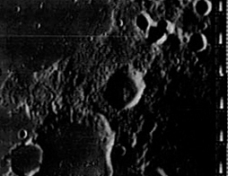
Carrington
Contents
Carrington
|
Lat: 44.0°N, Long: 62.1°E, Diam: 30 km, Depth: 2.73 km, [/R%C3%BCkl%2015 Rükl: 15] |
Table of Contents
[#Carrington Carrington]
[#Carrington-Images Images]
[#Carrington-Maps Maps]
[#Carrington-Description Description]
[#Carrington-Description: Elger Description: Elger]
[#Carrington-Description: Wikipedia Description: Wikipedia]
[#Carrington-Additional Information Additional Information]
[#Carrington-Nomenclature Nomenclature]
[#Carrington-LPOD Articles LPOD Articles]
[#Carrington-Bibliography Bibliography]
[#Carrington-R. C. Carrington in the Sourcebook Project (William R. Corliss) R. C. Carrington in the Sourcebook Project (William R. Corliss)]

LOIV 191 H2
Images
LPOD Photo Gallery Lunar Orbiter Images Apollo Images
Maps
([/LAC%20zone LAC zone] 28A4) USGS Digital Atlas PDF
Description
Description: Elger
([/IAU%20Directions IAU Directions]) CARRINGTON.--A small ring-plain, belonging to the [/Messala Messala] group, adjoining [/Schumacher Schumacher] on the N.E.
Description: Wikipedia
Additional Information
Depth data from [/Kurt%20Fisher%20crater%20depths Kurt Fisher database]
- Westfall, 2000: 2.73 km
Nomenclature
Richard Christopher Carrington (May 26, 1826 – November 27, 1875) was an English amateur astronomer who discovered the differential rotation of the sun by means of sunspot observations in 1863. In 1859 he and Richard Hodgson, another English amateur, independently made the first observations of a solar flare.
LPOD Articles
Bibliography
R. C. Carrington in the Sourcebook Project (William R. Corliss)
- Page 47 in: Mysterious Universe, a handbook of astronomical anomalies (1979) :
- A Supposed New Interior Planet (Monthly Notices of the Royal Astronomical Society, 1859).
This page has been edited 1 times. The last modification was made by - tychocrater tychocrater on Jun 13, 2009 3:24 pm - afx3u2