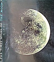
Times Atlas of the Moon
THE TIMES ATLAS OF THE MOON, edited by H. A. G. Lewis
Table of Contents

Description
Published in 1969 by Times Newspapers Limited, this atlas is "based on the magnificent work of the [/DMA U.S.A.F.], whose 1:1,000,000 Lunar Charts have been used with their permission." In other words, the [/LAC LAC] series.

  "The maps are at a scale of approximately 20 miles to one inch," which means that they are reduced by approximately 1/3 to 1:1,267,200.

  The book is hard covered with pages 34 cm high by 29 cm wide. The [/DMA ACIC]'s 44 LAC maps have been subdivided (without the original marginal information) into 55 two-page spreads (numbered 1..110) with small overlaps at the edges, an index map and pointers to the adjoining sheet numbers (as in a road atlas). As with the original LAC's, the maps cover most of the near side but do not extend to the limb. They are light beige with grey shaded relief. "The background colouring indicates the albedo...". Contours are shown on some (but not all), just as on the LAC series. North is up, east to the right. The Index lists the principal names and the page numbers on which they are found.
Additional Information
The maps are preceded by 37 pages of introductory material. Some of this is still useful, some quite amusing. It includes:
- Introduction
- The Moon: Size and mass, Rotation, Orbit, Librations, Tides, Phases, Physical data
- The Far Side
- Mapping the Moon: History, Modern techniques
- The Lunar Landscape: Mountains, Craters, Rilles, Scarps, Rays, Valleys, Ridges, Maria, Origins, Mascons, Geology
- Techniques of Lunar Flight: Orbital flight, Paths to the moon, How the Apollo flights were made
- Index to names
- How to use the atlas / Lunar names / Apollo missions
- Key to the maps
The front (north) and rear (south) end-pieces together show the entire nearside as a very clear 54 cm diameter disk (the US Air Force [/DMA Lunar Reference Mosaic]). A 26.5 cm diameter version, with page boundaries overlaid serves as the "Key to the maps"
There are three small 1:40,000,000 maps including the far side (an early version of the NASA [/LMP LMP] charts). One and a half pages show a Mercator projection of 48°N to 48°S while a second full page shows the north and south polar regions in Polar Gnomic projection. All are grayish shaded relief, with just a very few features named, and have sizable [/Luna%20Incognita Terra Incognito].
There are very small facsimiles of (parts of) the maps of:
- Galileo 1609/1610
- Hevelius 1647
- Riccioli 1651
- Cassini 1680
- Tobias Mayer 1775
- Wilkins 1946
The Lunar landscape section remains a useful introduction with well selected photographs of most feature types. One full page shows a section of a [/USGS USGS] geological map (with key) centered on [/Ptolemaeus Ptolemaeus].
It shows both the Apollo Lunar Orbit Chart (ALO) and the Landing Map (photo-mosaic) for [/Apollo%2011%20Site Apollo 11].
The formation of the Earth, Moon, and Mars
At page vi (6) of this atlas one could see a neat airbrushed greenish drawing which shows the theoretical formation of the three planetary bodies Earth, Moon, and Mars. According to this drawing, all three bodies came from one oblong body which stretched out like an "oil-blob" inside a Lava Lamp. The small central sphere-shaped body in the oily string should be the Moon, the largest one the Earth, and the medium-sized body the planet Mars. Several minute objects in the neighborhood of the three planetary bodies should be the asteroids.
Orbital photography
Interestingly, given the publication date, the Times Atlas of the Moon contains several orbital lunar photographs taken during the missions of Apollo 8, Apollo 10, and Apollo 11, and there are also several images from the Lunar Orbiter project.
Greek letters for domes, hillocks, hills, small mountains, insulae, and peninsulae
Certain charts in the Times Atlas of the Moon show a distinct kind of lunar nomenclature, a system which is nowadays no longer official: Greek letters for all sorts of small mountains and hillocks. For dedicated explorers of the moon, this nomenclature is (still) a very handy tool during telescopic observations of, for example, the partially shadowed peaks at the morning- or evening-terminator (to create a catalog of all sorts of clair-obscur phenomena at the moon's north-south running day/night boundary).
 2017... a new approach.
  Near the end of December 2016, the dedicated Flemish explorer of lunar maps and moon atlases (Danny Caes) decided to start a major investigation of the Greek lettered lunar surface formations, to add all of them into the 76 charts of the online revised lunar atlas of Antonin Rukl and also into the individual pages of the Moon-Wiki project (the grand ABC of named lunar surface formations).
  Wish me good luck! - DannyCaes DannyCaes Jan 7, 2017
  P.S.:
  It would be very interesting to add the Greek letter-nomenclature into the online ACT-REACT QUICK MAP of the LROC site!
LPOD Articles
Bibliography
- Lewis, H. A. G. and the Aeronautical Chart and Information Center. 1969. The Times Atlas of the Moon, Times Newspapers Limited, 1969.
This page has been edited 1 times. The last modification was made by - tychocrater tychocrater on Jun 13, 2009 3:24 pm - mgx2