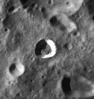
Tharp
Contents
Tharp
| Lat: 30.6°S, Long: 145.63 °E, Diam: 13.45 km, Depth: km, Rükl: (farside) |
Table of Contents
[#Tharp Tharp]
[#Tharp-Images Images]
[#Tharp-Maps Maps]
[#Tharp-Description Description]
[#Tharp-Wikipedia Wikipedia]
[#Tharp-Additional Information Additional Information]
[#Tharp-Nomenclature Nomenclature]
[#Tharp-LPOD Articles LPOD Articles]
[#Tharp-Lettered craters Lettered craters]
[#Tharp-Bibliography Bibliography]
Images
Tharp was perhaps captured on the orbital Apollo photographs of nearby craters Pavlov and Jules Verne.
Maps
([/LAC%20zone LAC zone] 49B2) USGS Digital Atlas PDF (LAC 102)
Description
Raycrater between Pavlov (to the northwest) and Jules Verne (to the southeast).
Wikipedia
Additional Information
- IAU page: Tharp
Nomenclature
- Marie; Geologist and oceanographer, created first comprehensive map of the ocean floor and is credited with discovering the Mid-Atlantic Ridge (1920-1986).
LPOD Articles
Lettered craters
Bibliography
[/Alphabetical%20Index Named Features] -- Prev: [/Thales Thales] -- Next: [/Theaetetus Theaetetus]
This page has been edited 1 times. The last modification was made by - tychocrater tychocrater on Jun 13, 2009 3:24 pm - afx3u3
