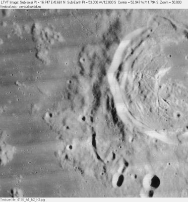
Rima Hansteen
Contents
Rima Hansteen
|
Lat: 12.0°S, Long: 53.0°W, Length: 25 km, Depth: km, [/R%C3%BCkl%2040 Rükl: 40] |
Table of Contents
[#Rima Hansteen Rima Hansteen]
[#Rima Hansteen-Images Images]
[#Rima Hansteen-Maps Maps]
[#Rima Hansteen-Description Description]
[#Rima Hansteen-Description: Wikipedia Description: Wikipedia]
[#Rima Hansteen-Additional Information Additional Information]
[#Rima Hansteen-Nomenclature Nomenclature]
[#Rima Hansteen-LPOD Articles LPOD Articles]
[#Rima Hansteen-Bibliography Bibliography]

LO-IV-156H
Images
LPOD Photo Gallery Lunar Orbiter Images
Maps
([/LAC%20zone LAC zone] 74C3) LAC map Geologic map
Description
Description: Wikipedia
Additional Information
Nomenclature
Named from nearby crater. ([/Hansteen Hansteen])
 Rimae Hansteen (an unofficial name for the system of rilles on the floor of crater Hansteen).
LPOD Articles
Bibliography
This page has been edited 1 times. The last modification was made by - tychocrater tychocrater on Jun 13, 2009 3:24 pm - afx3