Marconi
Contents
Marconi
| Lat: 9.6°S, Long: 145.1°E, Diam: 73 km, Depth: km, Rükl: (farside) |
Table of Contents
[#Marconi Marconi]
[#Marconi-Images Images]
[#Marconi-Maps Maps]
[#Marconi-Description Description]
[#Marconi-Description: Wikipedia Description: Wikipedia]
[#Marconi-Additional Information Additional Information]
[#Marconi-Nomenclature Nomenclature]
[#Marconi-LPOD Articles LPOD Articles]
[#Marconi-Bibliography Bibliography]


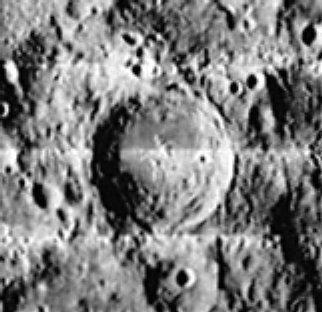
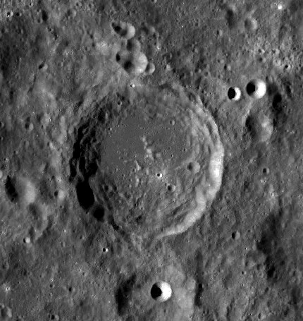
left: Lunar Orbiter I, right: LRO-WAC
Images
LPOD Photo Gallery Lunar Orbiter Images Apollo Images
AS13-62-8909 shows Apollo 13's Command Module Odyssey (left) and craters Schliemann' and Chaplygin (near centre), and also Marconi (a little bit "above" the white end of LM Aquariuss antenna). Although Apollo 13 was the most troubled one of Project Apollo's nine lunar flights, its crew made some spectacular orbital Hasselblad photographs of the moon's Far-Side craters! Image AS13-62-8909 is one of them. - DannyCaes DannyCaes Dec 13, 2007
Maps
([/LAC%20zone LAC zone] 84C2) USGS Digital Atlas PDF
Description
Description: Wikipedia
Additional Information
- TSI = 25, CPI = 20, FI = 20; MI =65 [/Smith%20and%20Sanchez%2C%201973 Smith and Hartnell, 1973] (CAW update)
Nomenclature
Guglielmo; Italian physicist, inventor; Nobel laureate (1874-1937).
- Marconi was among the long list of farside names approved by the IAU in 1970 and published in [/Menzel%2C%201971 Menzel, 1971].
- In the planning for Apollo 8, the first manned circumlunar mission (1968), this crater (which did not then have an official name) was referred to informally as "Kraft" (source: Phil Stooke's LPOD).
LPOD Articles
Bibliography
This page has been edited 1 times. The last modification was made by - tychocrater tychocrater on Jun 13, 2009 3:24 pm - afx3u2