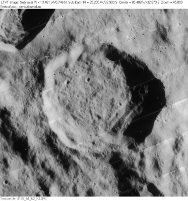
Shaler
Contents
Shaler (of the pair Wright-Shaler)
|
Lat: 32.9°S, Long: 85.2°W, Diam: 48 km, Depth: 3.31 km, Rükl: 61 |
LO-IV-186H
Shaler in the image's central section, its companion Wright in the upper left corner.
Images
LPOD Photo Gallery Lunar Orbiter Images
Maps
(LAC zone 109A1) USGS Digital Atlas PDF
Description
Description: Wikipedia
Additional Information
Depth data from Kurt Fisher database
- Westfall, 2000: 3.31 km
Nomenclature
- Nathaniel Southgate Shaler (1841-1906) was an American geologist and paleontologist who wrote in 1903 one of the first geologic studies of the Moon: A Comparison of the Features of the Earth and the Moon.
- Name given by Arthur and Whitaker in Rectified Lunar Atlas (1963) and approved by IAU in 1964 (Whitaker, 1999, p234).
LPOD Articles
Bibliography
- On-line/downloadable copy of Shaler's book.
