Rimae Cleomedes
Contents
Rimae Cleomedes
|
Lat: 27.0°N, Long: 57.0°E, Length: 80 km, Depth: km, Rükl: 26 |

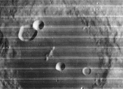
LOIV-054-H3
In this Lunar Orbiter IV image there's not much to see of the system of rilles on the floor of Cleomedes.
The close-up of Cleomedes in the online LROC Act-React Quick Map however shows several connected rilles like branches from a tree, or lightning strokes, on the eastern part of the crater's floor. The main section of this system of rilles was once known as Rima Cleomedes I.
Images
LPOD Photo Gallery Lunar Orbiter Images Apollo Images
Maps
(LAC zone 44A3) LAC map Geologic map
Description
Description: Wikipedia
Additional Information
Nomenclature
Within crater Cleomedes (on its floor).
  The most pronounced part of the system of rilles on the floor of Cleomedes is called Rima Cleomedes I on Charts 22 and 33 in the Times Atlas of the Moon (1969).
  On Chart A3 of the SLC (System of Lunar Craters) it (Rima Cleomedes I) is depicted as a straight line running from the eastern part of Cleomedes's rim toward Cleomedes E in Cleomedes itself (no traces of the other members of the Rimae Cleomedes system).
LPOD Articles
Bibliography