Lubbock
Contents
Lubbock
| Lat: 3.9°S, Long: 41.8°E, Diam: 13 km, Depth: 0.3 km, Rükl: 48 |
Table of Contents
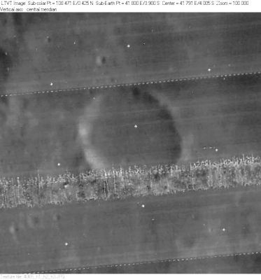
 LO-IV-065H
Images
LPOD Photo Gallery Lunar Orbiter Images Apollo Images
- Oblique north-looking close ups of Lubbock were made during the mission of Apollo 16. Orbital ITEK-panoramic frames AS16-P-4480 and AS16-P-4485 show Lubbock's ring-like appearance near the right margins of both frames.
- Apollo 11's orbital photographs AS11-42-6309 and 6310 are almost identical-twin frames of the rille system near Lubbock H (the odd crater slightly below-right of both the photograph's centres). Note the very odd depressions and the catena-like (chain-like) rimae! This region is located slightly north of Lubbock itself.
Detection of the Lubbock H region on these two Apollo 11 photographs: Danny Caes, via chart 60 in the Times Atlas of the Moon and Lunar Orbiter 4 photograph IV-066-h1 (Lubbock H and its rilles are located near the lower margin of this photograph).
- Lunar Orbiter 1's frame 1052 shows Lubbock R (upper left corner) and NASA's Smokey Valley (below centre of frame).
- Research L.O. and Apollo photography: Danny Caes
Maps
([/LAC%20zone LAC zone] 79B1) LAC map Geologic map AIC map LTO map
Description
Description: Elger
([/IAU%20Directions IAU Directions]) LUBBOCK.--A brilliant little crater, about 4 or 5 miles in diameter, near the W. coast-line of the [/Mare%20Fecunditatis Mare Fecunditatis]. The region W. of this object is particularly well worthy of scrutiny under a low sun, on account of the variety of detail it includes. On the S.W. run three fine parallel clefts, originating near the N. end of [/Montes%20Pyrenaeus The Pyrenees].
Description: Wikipedia
Additional Information
Depth data from [/Kurt%20Fisher%20crater%20depths Kurt Fisher database]
- Westfall, 2000: 0.3 km
- Viscardy, 1985: 0.58 km
Lubbock D, a crater west of Lubbock itself, shows an "extra internal rim" at the northwestern part of its inner slopes. - DannyCaes DannyCaes Aug 9, 2014
Nomenclature
Sir John William; British astronomer, mathematician (1803-1865).
- According to [/Whitaker Whitaker] (p. 223), this name was introduced by [/Neison Neison].
The crater Lubbock R at 0.1° South/ 40.4° East was erroneously printed as Lubbock P on chart 60 of the Times Atlas of the Moon.- DannyCaes DannyCaes May 14, 2011
LPOD Articles
Bibliography
This page has been edited 1 times. The last modification was made by - tychocrater tychocrater on Jun 13, 2009 3:24 pm - afx3u2