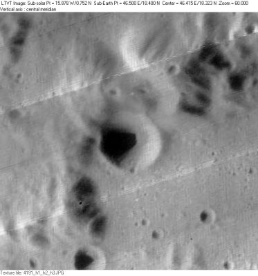
Fredholm
Contents
Fredholm
(formerly Macrobius D)
|
Lat: 18.4°N, Long: 46.5°E, Diam: 14 km, Depth: 2.56 km, Rükl: 26 |
Images
LPOD Photo Gallery Lunar Orbiter Images Apollo Images
Fredholm was also captured on Apollo 15's orbital ITEK-panoramic frame AS15-P-9249.
Research: Danny Caes
Fredholm's bright "dome"
The somewhat bulbous looking hill or "dome" to the north of Fredholm (between Macrobius and Proclus) looks deceptively "bright" and "cloudy" on pre-sunset photographs of Mare Crisium's western part, see Howard Eskildsen's LPOD May 2nd, 2013 and Alex Sanz's LPOD August 28th, 2013.
  Detection of Fredholm's "bright cloudy dome": Danny Caes (is this a phenomenon which could be observed during each lunation, always before local sunset?).
Maps
(LAC zone 43C3) LAC map Geologic map LTO map
Description
Description: Wikipedia
Additional Information
- Depth data from Kurt Fisher database
- Westfall, 2000: 2.56 km
- The peak on the west rim is 2750 m above the floor. - Jim Mosher
Nomenclature
- Erik Ivar; Swedish mathematician (1866-1927).
- This replacement name for a formerly lettered crater was introduced on LTO-43C3. - Jim Mosher
LPOD Articles
Bibliography
