Yangel', Rima
Contents
Rima Yangel'
(unofficially known as Fossa Yangel')
|
Lat: 16.7°N, Long: 4.6°E, Length: 30 km, Depth: km, Rükl: 22 | |
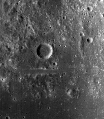
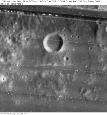
Right: LO-IV-102H Yangel' is the circular crater above center. The 2-km wide Rima Yangel' runs horizontally across the center of the frame below it.
Table of Contents
[#Rima Yangel' Rima Yangel']
[#Rima Yangel'-Images Images]
[#Rima Yangel'-Maps Maps]
[#Rima Yangel'-Description Description]
[#Rima Yangel'-Description: Wikipedia Description: Wikipedia]
[#Rima Yangel'-Additional Information Additional Information]
[#Rima Yangel'-Nomenclature Nomenclature]
[#Rima Yangel'-LPOD Articles LPOD Articles]
[#Rima Yangel'-Bibliography Bibliography]
Images
LPOD Photo Gallery Lunar Orbiter Images Apollo Images (for Rima Yangel', see Manilius F, the crater officially known as Yangel').
- Rima Yangel' was also captured on frame AS15-M-2573, made by the southward looking Fairchild camera of Apollo 15 (both crater Yangel' and nearby Rima Yangel' are noticeable slightly rightward of the frame's centre).
- Research Danny Caes
Maps
(LAC zone 41C4) LAC map Geologic mapLM map LTO map
Description
Description: Wikipedia
Additional Information
High Albedo ray-craterlet near (or south of) the western part of Rima Yangel'. A good test object for telescopic observers of the Full Moon.- DannyCaes DannyCaes Jun 9, 2012
Nomenclature
Named from nearby crater. (Yangel')
  Unofficially known as Fossa Yangel' on Lunar Topographic Orthophotomap 41-C4.
LPOD Articles
Bibliography
This page has been edited 1 times. The last modification was made by - tychocrater tychocrater on Jun 13, 2009 3:24 pm - afx1u2

