Ibn Yunus
Contents
Ibn Yunus
| Lat: 14.1°N, Long: 91.1°E, Diam: 58 km, Depth: km, Rükl: (farside) |
Table of Contents
[#Ibn Yunus Ibn Yunus]
[#Ibn Yunus-Images Images]
[#Ibn Yunus-Maps Maps]
[#Ibn Yunus-Description Description]
[#Ibn Yunus-Description: Wikipedia Description: Wikipedia]
[#Ibn Yunus-Additional Information Additional Information]
[#Ibn Yunus-Nomenclature Nomenclature]
[#Ibn Yunus-LPOD Articles LPOD Articles]
[#Ibn Yunus-Bibliography Bibliography]


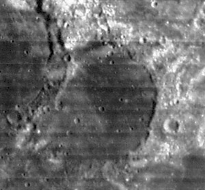
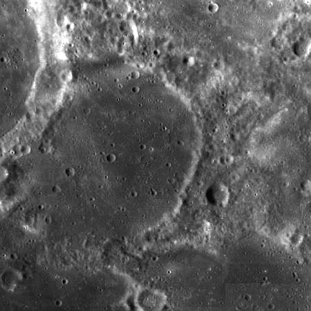
left: Lunar Orbiter LO4-018-H2 . right: LROC
Images
LPOD Photo Gallery Lunar Orbiter Images Apollo Images
Maps
(LAC zone 64A1) USGS Digital Atlas PDF
Description
The lava-flooded remnant of what was once a grand crater. First Goddard formed on it's western edge, and later magmas rose up through fissures and flooded the crater, covering the central peak and terraces, making it part of Mare Marginis. At some point bright spots that are pieces of the Marginis Swirl developed on the mare lavas, and small impacts pitted the surface. The crater is just barely on the farside but can be easily spotted with good libration. - tychocrater tychocrater Jun 23, 2007
Description: Wikipedia
Additional Information
Nomenclature
Ibn Yunus (950?-1009) was an important Egyptian mathematician and astronomer whose works are noted for being ahead of their time, having been based on almost modern-like meticulous calculations and attention to detail.
LPOD Articles
Bibliography
This page has been edited 1 times. The last modification was made by - tychocrater tychocrater on Jun 13, 2009 3:24 pm - afx3u2