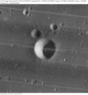
Heinrich
Contents
Heinrich
(formerly Timocharis A)
|
Lat: 24.8°N, Long: 15.3°W, Diam: 6 km, Depth: 1.46 km, Rükl: 21 |
Table of Contents
[#Heinrich Heinrich]
[#Heinrich-Images Images]
[#Heinrich-Maps Maps]
[#Heinrich-Description Description]
[#Heinrich-Description: Wikipedia Description: Wikipedia]
[#Heinrich-Additional Information Additional Information]
[#Heinrich-Nomenclature Nomenclature]
[#Heinrich-LPOD Articles LPOD Articles]
[#Heinrich-Bibliography Bibliography]

LO-IV-121H
Images
LPOD Photo Gallery Lunar Orbiter Images Apollo Images
Heinrich was also captured on Apollo 17's orbital ITEK-panoramic frame AS17-P-3068 (scroll to the right).
Research: Danny Caes
Maps
(LAC zone 40B4) LAC map Geologic map LTO map
Description
Description: Wikipedia
Additional Information
Depth data from Kurt Fisher database
- Westfall, 2000: 1.46 km
- Viscardy, 1985: 1.42 km
- From the shadows in LO-IV-121H, Heinrich is about 1500 m deep.
Nomenclature
Wladimir Wáclav; Czechoslovakian astronomer (1884-1965).
- This replacement name for a formerly lettered crater was introduced on LTO-40B4 (for which it served as the chart title). - JimMosher JimMosher
LPOD Articles
Bibliography
This page has been edited 1 times. The last modification was made by - tychocrater tychocrater on Jun 13, 2009 3:24 pm - afx3u2