Beals
Contents
Beals
(formerly Riemann A)
|
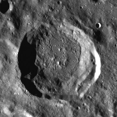
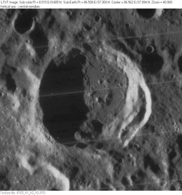
Lat: 37.3°N, Long: 86.5°E, Diam: 48 km, Depth: 3.15 km, Rükl: 16 |

left: LO-IV-165H . right: LROC
Images
LPOD Photo Gallery Lunar Orbiter Images
Maps
(LAC zone 29D1) USGS Digital Atlas PDF
Description
Description: Wikipedia
Additional Information
Depth data from Kurt Fisher database
- Westfall, 2000: 3.15 km
Nomenclature
- Named for Carlyle Smith Beals(1899-1979), a Canadian astronomer. Beals was one of the early group of Canadian astronomers who recognized that some of the circular lakes on Earth there were likely to be impact craters. - tychocrater Aug 13, 2007
- According to Whitaker (p. 236), this replacement name for a formerly lettered crater was introduced in NASA RP-1097. The name was approved by the IAU in 1982 (IAU Transactions XVIIIB).
- Danny Caes identifies Beals as the original location of the farside name Rynin, whose location was moved subsequent to the October, 1970 printing of the first "official" ACIC maps of the new IAU farside nomenclature (Menzel, 1971). Danny apparently bases this on the name Rynin being printed at the position of the present Beals on, for example, Antonín Rükl's 1972 Maps of lunar hemispheres. However, if used for the present Beals, Rynin would not technically have been a farside name. The misprinting of Rynin on these maps is one of 22 errors or omissions that Rükl lists in the accompanying pamphlet. - Jim Mosher
- The name Beals is not mentioned on page 59 (LAC 29) of the Clementine Atlas (2004).- DannyCaes Oct 10, 2011
- Rimae Beals (an unofficial name from a dedicated investigator of not-officially named lunar rilles for the system of rilles on the floor of Beals).
LPOD Articles
Bibliography
