Rothmann
Contents
Rothmann
|
Lat: 30.8°S, Long: 27.7°E, Diam: 42 km, Depth: 4.22 km, Rükl: 67, Eratosthenian |
Table of Contents
[#Rothmann Rothmann]
[#Rothmann-Images Images]
[#Rothmann-Maps Maps]
[#Rothmann-Description Description]
[#Rothmann-Description: Wikipedia Description: Wikipedia]
[#Rothmann-Additional Information Additional Information]
[#Rothmann-Nomenclature Nomenclature]
[#Rothmann-LPOD Articles LPOD Articles]
[#Rothmann-Bibliography Bibliography]

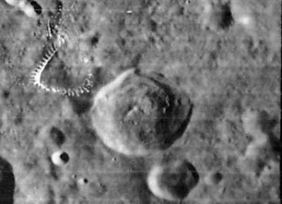
LOIV 084 H1
Images
LPOD Photo Gallery Lunar Orbiter Images Apollo Images
Maps
(LAC zone 96C3) LAC map Geologic map
Description
Description: Wikipedia
Additional Information
Depth data from Kurt Fisher database
- Westfall, 2000: 4.22 km
- Viscardy, 1985: 4.2 km
- Cherrington, 1969: 3.01 km
Nomenclature
- Christopher Rothmann (unkn-1600) was a German astronomer.
  - Satellite crater ROTHMANN E is printed as ROTHMAN E (without the second "N") on LAC 113 (page 227) in the REVISED AND UPDATED EDITION of the Clementine Atlas of the Moon (CAMBRIDGE UNIVERSITY PRESS, 2012).- DannyCaes DannyCaes Jan 6, 2013
LPOD Articles
Bibliography
This page has been edited 1 times. The last modification was made by - tychocrater tychocrater on Jun 13, 2009 3:24 pm - afx3u2