Difference between revisions of "Cajori"
| Line 5: | Line 5: | ||
|- | |- | ||
| | | | ||
| − | [http://lpod.org/coppermine/displayimage.php?pid=4224&fullsize=1 [[Image: | + | [http://lpod.org/coppermine/displayimage.php?pid=4224&fullsize=1 [[Image:Normal_cajori-large.jpg|external image normal_cajori-large.jpg]]][[Image:Cajori.jpg|Cajori.jpg]]<br /> |
| | | | ||
| − | [[Image: | + | [[Image:Cajori-color.jpg|cajori-color.jpg]]<br /> |
|} | |} | ||
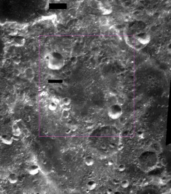
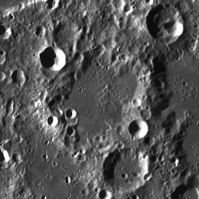
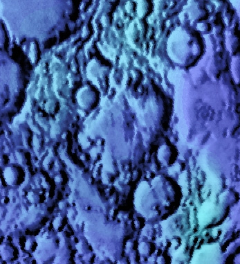
''Left: [http://the-moon.us/wiki/file/detail/cajori-large2.jpg Combined]'' [http://pdsmaps.wr.usgs.gov/explorer-bin/mapmars4.cgi?WHEREFROM=COLOR&VERSION=INTERMEDIATE&DATA_SET_NAME=moon_clementine_bw&PIXEL_TYPE=BIT8&SCALE=pixels/degree&PROJECTION=SINUSOIDAL&RESOLUTION=64&RESAMP_METHOD=NEAREST_NEIGHBOR&BANDS_SELECTED=&FORMAT=JPEG&LONBOX=16&LATBOX=16&GRIDLINE_FREQUENCY=none&STRETCH=NONE&LAT=-45&LON=165&LINE=1024&SAMP=818 Clementine] . ''center: '''LROC'''''<br /> ''Right:'' [http://planetarynames.wr.usgs.gov/images/Lunar/lac_119.pdf Color-coded Lac 119] from [http://the-moon.us/wiki/USGS%20Digital%20Atlas USGS Digital Atlas]<br /> <div id="toc"> | ''Left: [http://the-moon.us/wiki/file/detail/cajori-large2.jpg Combined]'' [http://pdsmaps.wr.usgs.gov/explorer-bin/mapmars4.cgi?WHEREFROM=COLOR&VERSION=INTERMEDIATE&DATA_SET_NAME=moon_clementine_bw&PIXEL_TYPE=BIT8&SCALE=pixels/degree&PROJECTION=SINUSOIDAL&RESOLUTION=64&RESAMP_METHOD=NEAREST_NEIGHBOR&BANDS_SELECTED=&FORMAT=JPEG&LONBOX=16&LATBOX=16&GRIDLINE_FREQUENCY=none&STRETCH=NONE&LAT=-45&LON=165&LINE=1024&SAMP=818 Clementine] . ''center: '''LROC'''''<br /> ''Right:'' [http://planetarynames.wr.usgs.gov/images/Lunar/lac_119.pdf Color-coded Lac 119] from [http://the-moon.us/wiki/USGS%20Digital%20Atlas USGS Digital Atlas]<br /> <div id="toc"> | ||
Latest revision as of 02:43, 16 April 2018
Contents
[hide]Cajori
| Lat: 47.4°S, Long: 168.8°E, Diam: 70 km, Depth: km, Rükl: (farside) | |
Right: Color-coded Lac 119 from USGS Digital Atlas
Images
LPOD Photo Gallery Lunar Orbiter Images Apollo Images
Maps
(LAC zone 119C4) USGS Digital Atlas PDF
Description
Cajori lies within the South Pole Aitken Basin -- a 2500 kilometre-wide basin of the pre-Nectarian period (~ 4.6 to 3.92 bn years). The crater looks very worn and is, somewhat, lost and altered amidst a jumble of impacts crater both to its north and south -- mixed, possibly, with lava flooding deposits within its interior. Cajori doesn't take on your regular circular-looking appearance, but rather looks skewed diagonally in a north-east/south-west direction due to these latter influences.
Description: Wikipedia
Additional Information
Nomenclature
Florian; American mathematician (1859-1930).
LPOD Articles
Bibliography


