Difference between revisions of "Delmotte"
| Line 20: | Line 20: | ||
** Viscardy, 1985: 3 km | ** Viscardy, 1985: 3 km | ||
* Central peak height | * Central peak height | ||
| − | ** [[Sekiguchi%2C%201972|Sekiguchi, 1972]]: <0.8 km <span class="membersnap">- | + | ** [[Sekiguchi%2C%201972|Sekiguchi, 1972]]: <0.8 km <span class="membersnap">- fatastronomer</span> |
| − | * From the shadows in LO-IV-097H, '''Delmotte''' is 2300-3750 m deep. <span class="membersnap">- | + | * From the shadows in LO-IV-097H, '''Delmotte''' is 2300-3750 m deep. <span class="membersnap">- JimMosher</span> |
<br /> | <br /> | ||
==Nomenclature== | ==Nomenclature== | ||
Latest revision as of 20:10, 16 April 2018
Contents
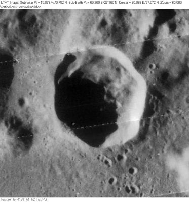
Delmotte
|
Lat: 27.1°N, Long: 60.2°E, Diam: 32 km, Depth: 4.36 km, Rükl: 26, Eratosthenian |
Images
LPOD Photo Gallery Lunar Orbiter Images Apollo Images
Are there really no orbital Apollo photographs of Delmotte? - DannyCaes May 9, 2015
Maps
(LAC zone 44B4) LAC map Geologic map
Description
Description: Wikipedia
Additional Information
- Depth data from Kurt Fisher database
- Westfall, 2000: 4.36 km
- Viscardy, 1985: 3 km
- Central peak height
- Sekiguchi, 1972: <0.8 km - fatastronomer
- From the shadows in LO-IV-097H, Delmotte is 2300-3750 m deep. - JimMosher
Nomenclature
- Gabriel Delmotte (1876-1950); French astronomer who published Nouvelle Theorie des Cirques Lunaires in 1923.
- Named by Lamèch (Whitaker, p 228).
LPOD Articles
Bibliography
About G.Delmotte's Aires Elliptiques (traces of possible ancient "ghost"-craters on the moon), see page 181 in the Dutch moonbook Op Ontdekking in het Maanland by A.J.M.Wanders (Het Spectrum, 1949). - DannyCaes May 9, 2015
