Difference between revisions of "Palus Putredinis"
(Created page with "<div id="content_view" class="wiki" style="display: block"> =Palus Putredinis= {| class="wiki_table" | Lat: 26.5°N, Long: 0.4°E, Diam: 161 km, Depth: km, [/R%C3%BCkl%202...") |
|||
| Line 23: | Line 23: | ||
"Marsh of Decay".<br /> <br /> | "Marsh of Decay".<br /> <br /> | ||
==LPOD Articles== | ==LPOD Articles== | ||
| − | [http:// | + | [http://www2.lpod.org/wiki/May_28,_2006 A Ho-Hum Place] [http://www2.lpod.org/wiki/January_22,_2006 A Corner of Decay] [http://www2.lpod.org/wiki/October_8,_2007 Slithering and Sliding]<br /> <br /> |
==LROC Articles== | ==LROC Articles== | ||
[http://lroc.sese.asu.edu/posts/433 Shiny Mound] (the high-albedo "island" west of the '''Rima Hadley''' complex, at '''Palus Putredinis''').<br /> <br /> | [http://lroc.sese.asu.edu/posts/433 Shiny Mound] (the high-albedo "island" west of the '''Rima Hadley''' complex, at '''Palus Putredinis''').<br /> <br /> | ||
Revision as of 19:26, 11 April 2018
Contents
Palus Putredinis
|
Lat: 26.5°N, Long: 0.4°E, Diam: 161 km, Depth: km, [/R%C3%BCkl%2022 Rükl: 22] |
Table of Contents
[#Palus Putredinis Palus Putredinis]
[#Palus Putredinis-Images Images]
[#Palus Putredinis-Maps Maps]
[#Palus Putredinis-Description Description]
[#Palus Putredinis-Description: Wikipedia Description: Wikipedia]
[#Palus Putredinis-Additional Information Additional Information]
[#Palus Putredinis-Nomenclature Nomenclature]
[#Palus Putredinis-LPOD Articles LPOD Articles]
[#Palus Putredinis-LROC Articles LROC Articles]
[#Palus Putredinis-Bibliography Bibliography]

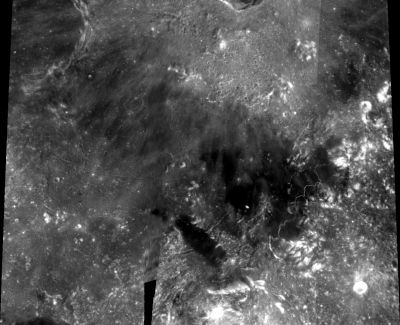
Source: Clementine (from Paolo Amoroso)
Images
LPOD Photo Gallery Lunar Orbiter Images Apollo Images
Two of Chesley Bonestell's extraordinary paintings, online in Fabio Femino's page Collier's-1 show orbital views of Palus Putredinis and nearby craters Archimedes, Autolycus, and Aristillus (see bottom of that page). Research: Danny Caes
Maps
([/LAC%20zone LAC zone] 41B4) LAC map Geologic map LM map LTO map
Description
Description: Wikipedia
Additional Information
- Mare area of 8,350 km^2 according to measurements by Jim Whitford-Stark.
- The lunar dome (located in Palus Putredinis) termed Putredinis 1 has a diameter of 7.0±0.5 km and a height of 90±10 m resulting in a flank slope of 1.47° and an edifice volume of 1.78 km³. According to the inferred spectral, morphometric, and rheologic properties, the dome Putredinis 1 belongs to class C2 in the GLR classification scheme of effusive domes (A Study About a Lunar Dome in Palus Putredinis by Raffaello Lena, Christian Wöhler and George Tarsoudis of the Geologic Lunar Research (GLR) group published in the Fall 2009 issue of Selenology: Journal Of the American Lunar Society).- fatastronomer fatastronomer
Nomenclature
"Marsh of Decay".
LPOD Articles
A Ho-Hum Place A Corner of Decay Slithering and Sliding
LROC Articles
Shiny Mound (the high-albedo "island" west of the Rima Hadley complex, at Palus Putredinis).
Bibliography
This page has been edited 1 times. The last modification was made by - tychocrater tychocrater on Jun 13, 2009 3:24 pm - afx2u2