Difference between revisions of "Bjerknes"
| Line 11: | Line 11: | ||
|} | |} | ||
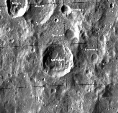
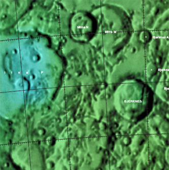
'''Left:''' [http://planetarynames.wr.usgs.gov/images/Lunar/lac_117_lo.pdf Lunar Orbiter LAC 117] '''Right:''' [http://planetarynames.wr.usgs.gov/images/Lunar/lac_117.pdf Color-coded LAC 117] -- both images from the [http://the-moon.us/wiki/USGS%20Digital%20Atlas USGS Digital Atlas].<div id="toc"> | '''Left:''' [http://planetarynames.wr.usgs.gov/images/Lunar/lac_117_lo.pdf Lunar Orbiter LAC 117] '''Right:''' [http://planetarynames.wr.usgs.gov/images/Lunar/lac_117.pdf Color-coded LAC 117] -- both images from the [http://the-moon.us/wiki/USGS%20Digital%20Atlas USGS Digital Atlas].<div id="toc"> | ||
| − | + | <br /> | |
| − | |||
==Images== | ==Images== | ||
[http://www.lpod.org/coppermine/thumbnails.php?album=search&type=full&search=Bjerknes LPOD Photo Gallery] [http://www.lpi.usra.edu/resources/lunar_orbiter/bin/srch_nam.shtml?Bjerknes%7C0 Lunar Orbiter Images] [http://www.lpi.usra.edu/resources/apollo/search/feature/?feature=Bjerknes Apollo Images]<br /> '''Bjerknes''' was captured near the upper right corner of Apollo 17's ''Fairchild''-camera photograph [http://www.lpi.usra.edu/resources/apollo/frame/?AS17-M-3183 AS17-M-3183], which was made during Trans Earth Coast (TEC).<br /> Research: Danny Caes<br /> <br /> | [http://www.lpod.org/coppermine/thumbnails.php?album=search&type=full&search=Bjerknes LPOD Photo Gallery] [http://www.lpi.usra.edu/resources/lunar_orbiter/bin/srch_nam.shtml?Bjerknes%7C0 Lunar Orbiter Images] [http://www.lpi.usra.edu/resources/apollo/search/feature/?feature=Bjerknes Apollo Images]<br /> '''Bjerknes''' was captured near the upper right corner of Apollo 17's ''Fairchild''-camera photograph [http://www.lpi.usra.edu/resources/apollo/frame/?AS17-M-3183 AS17-M-3183], which was made during Trans Earth Coast (TEC).<br /> Research: Danny Caes<br /> <br /> | ||
| Line 31: | Line 30: | ||
<br /> <br /> | <br /> <br /> | ||
---- | ---- | ||
| − | + | </div> | |
Revision as of 16:15, 15 April 2018
Contents
Bjerknes
|
Lat: 38.4°S, Long: 113.0°E, Diam: 48 km, Depth: km, Rükl: (farside), Upper Imbrian | |
Images
LPOD Photo Gallery Lunar Orbiter Images Apollo Images
Bjerknes was captured near the upper right corner of Apollo 17's Fairchild-camera photograph AS17-M-3183, which was made during Trans Earth Coast (TEC).
Research: Danny Caes
Maps
(LAC zone 117A3) USGS Digital Atlas PDF
Description
Aged as Late Imbrium (~ 3.85 to 3.8 bn years), Bjerknes more than likely formed on ejecta deposits from the Australe Basin - a 880 kilometre-wide basin of the pre-Nectarian period (~ 4.6 to 3.92 bn years) whose outer rim lies just ~ 150 kilimetres away to its south-west. The crater has a somewhat sharp-ish rim for its age, but on closer examination signatures of inner wall-collapse, terracing and an infilled centre suggest Bjerknes has been through the time-mill. Only one or two small craters dot its centre and south-western rim. - JohnMoore2 JohnMoore2
Description: Wikipedia
Additional Information
- TSI = 25, CPI = 15, FI = 10; MI =50 Smith and Hartnell, 1973
Nomenclature
Vilhelm Friman Koren; Norwegian physicist (1862-1951).
LPOD Articles
Bibliography

