Beaumont
Contents
Beaumont
|
Lat: 18.0°S, Long: 28.8°E, Diam: 53 km, Depth: 0.55 km, Rükl: 58 |

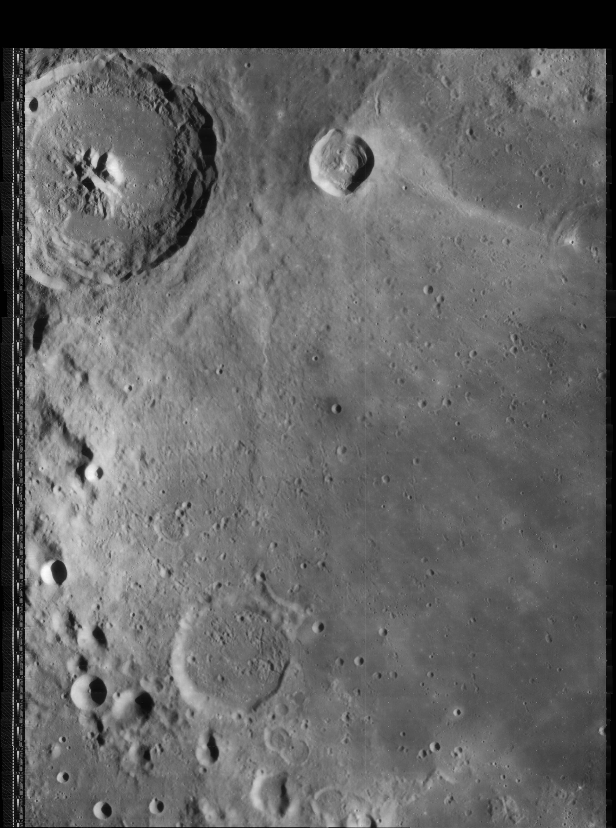
George Tarsoudis, Beaumont (left) & Fracastorius (right)
Images
LPOD Photo Gallery Lunar Orbiter Images Apollo Images
- The Hi-Res scan of Lunar Orbiter 4's photo LOIV-77-h2 shows the Concentric Crater southeast of Beaumont and north of Beaumont P. This Concentric Crater (CC number 6 in C.A.Wood's list of 1978) is depicted near the frame's lower margin.
- Beaumont itself was also captured in Apollo 16's oblique south-looking Fairchild-camera frames of REVOLUTION 26, such as frame AS16-M-0690 (in this frame, Beaumont's location is detectable near the central part of the curved horizon).
- Research Lunar Orbiter 4 and Apollo 16 photographs: Danny Caes
Maps
(LAC zone 96B2) LAC map Geologic map
Description
Description: Elger
(IAU Directions) BEAUMONT.--A ring-plain about 30 miles in diameter, on the S.W. side of the Mare Nectaris, midway between Theophilus and Fracastorius, with the N.W. side of which it is connected by a chain of large depressions. Its border is lofty, regular, and continuous on the S. and W., but on the E. it is low, and on the N. sinks to such a very inconsiderable height that it is often scarcely traceable. It exhibits two breaks on the S.E., through one of which passes a coarse valley that ultimately runs on the W. side of the depressions just referred to. The interior is pitted with many craters, one on the E. side being shallow but of considerable size. I once counted twenty with a 4 inch Cooke achromatic, and Dr. Sheldon of Macclesfield subsequently noted many more. A ridge, prominent under oblique light, follows a winding course from the N.E. side of Beaumont to the E. side of Theophilus, and there is another lower ridge W. of it. Between them is included a region covered with minute hillocks and asperities. Among these objects are certain dusky little crater-cones, which Dr. Klein of Cologne regards as true analogues of some terrestrial volcanoes. They are very similar in character to those, already alluded to, in the dusky area between Copernicus and Gambart.
Description: Wikipedia
Additional Information
- Depth data from Kurt Fisher database
- Westfall, 2000: 0.55 km
- Cherrington, 1969: 2.01 km
- Concentric crater north of Beaumont P
- Satellite craters Beaumont A, D and E are on the ALPO list of banded craters
Color Anomaly in Beaumont L
- During the mission of Apollo 14, a color anomaly was noticed in craterlet Beaumont L (14°30' south/ 30° east), during orbital observations. This color anomaly is described in the book Apollo 14 Preliminary Science Report (pages 275-276). The close-up photographs of Beaumont L, made by the LRO, show some sort of bulbous central peak or "egg-in-a-nest" like appearance.- DannyCaes May 24, 2011
- This color anomaly is also noticeable in the LROC's WAC albedo/color map, see close-up of the Beaumont L region: http://bit.ly/1xbKEc5
Nomenclature
- Jean-Baptiste Armand Louis Léonce Élie de Beaumont (September 25, 1798 – September 21, 1874) was a French geologist. His name is widely known to geologists in connection with his theory of the origin of mountain ranges. Probably, however, the best service Élie de Beaumont rendered to science was in connection with the geological map of France.
- The pronounced ridge immediately north of Beaumont is unofficially called Dorsum Beaumont or Beaumont's Twentynine East Ridge by Danny Caes. It is an interesting telescopic target during oblique illumination! The name Beaumont's Twentynine East Ridge is, in some way, a "lunar variant" of Earth's officially named Ninety East Ridge on the floor of the Indian Ocean (source: The Earth's Fractured Surface, a map made by the National Geographic Society, April 1995). - DannyCaes Sep 4, 2011
- On charts 72 and 73 in the Times Atlas of the Moon (1969) the pronounced ridge north of Beaumont is officially called Rima Beaumont I. It is unnamed on charts 47 and 58 of Antonin Rukl's atlas.- DannyCaes Jan 24, 2013
- Beaumont Delta (hill south of Beaumont and Beaumont M) (see Chart 85 in the Times Atlas of the Moon).
LPOD Articles
Bibliography