Artem'ev
Contents
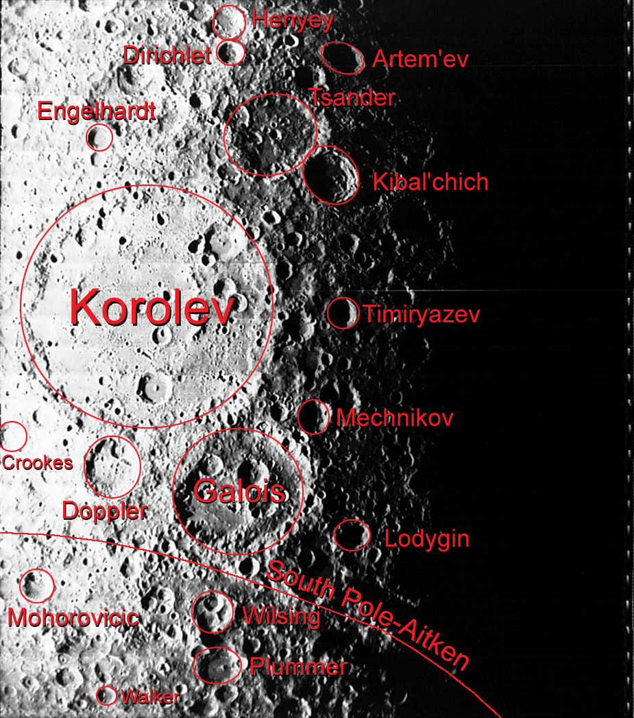
Artem'ev
| Lat: 10.8°N, Long: 144.4°W, Diam: 67 km, Depth: km, Rükl: (farside) |


Left: Annotated image from Apollo Footprint Viewer. Right: Color-Coded-LAC 70 from USGS Digital Atlas of the Moon.
Images
LPOD Photo Gallery Lunar Orbiter Images Apollo Images
- Note: Artem'ev can be found in LAC 70 of the USGS Digital Atlas of the Moon, however, as this LAC is currently under construction (as of 31 May 2009 at time of writing), updates should be checked for.
Maps
(LAC zone 70A3) USGS Digital Atlas PDF
Description
Artem'ev formed during the Early Imbrium epoch -- 3.85 - 3.8 bn years ago. Several small craters as well as two to three small peaks lie on its relatively flat floor -- the southern portion of which seems to be covered by collapsed rim material more than is northern portion. The crater has impacted upon an older crater, Artem'ev G, to the east, and both lie on ejecta deposits formed from the Hertzsprung Basin (Nec ~ 3.92 - 3.85 bn old) whose centre lies some 600 kilometres away in the south-east direction. - JohnMoore2
- What is that massive ridge on the left side of Artem'ev? Usually a massif like that is a portion of a degraded basin rim, but Artem'ev is far from the rim of the most likely suspect, the South Pole-Aitken Basin. - tychocrater May 31, 2009
Description: Wikipedia
Additional Information
Nomenclature
- Named for Vladimir Andreevich Artem'ev (1885-1962), a Soviet rocket scientist.
- Artem'ev was in the initial list of farside names announced by the IAU in Menzel, 1971.
LROC Articles
Physics is Fun! (the unnamed bowl-shaped crater south-southwest of Artem'ev L).
A Tiny, Glancing Blow (a very tiny ray-craterlet immediately east of the unnamed bowl-shaped crater south-southwest of Artem'ev L).
Bibliography