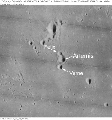
Verne
Contents
Verne (with Artemis and Felix)
|
Lat: 24.9°N, Long: 25.3°W, Diam: 2 km, Depth: km, Rükl: 20 |
LO-IV-133H. The other IAU-named features in this field south of Mons La Hire and between Euler and Lambert are Felix and Artemis
Images
LPOD Photo Gallery Lunar Orbiter Images Apollo Images
For orbital Apollo photographs of Verne, see page Artemis (which is the largest one of the triplet).
Maps
(LAC zone 40A4) LAC map Geologic map LTO map Topophotomap
Description
Description: Wikipedia
Additional Information
Nomenclature
Latin male name.
- According to NASA RP-1097, "Verne" is a Minor Feature whose name was originally intended only for use in connection with Topophotomap 40A4/S1(on which it is plotted).
- This feature should not be confused with the farside crater Jules Verne.
- On Antonin Rukl's chart 20 of his Atlas of the Moon, the name Verne was printed a bit too far to the southeast of its companion Artemis.- DannyCaes May 26, 2010
LPOD Articles
Bibliography
