Saunder
Contents
Saunder
|
Lat: 4.2°S, Long: 8.8°E, Diam: 44 km, Depth: 0.64 km, [/R%C3%BCkl%2045 Rükl: 45] |
Table of Contents
[#Saunder Saunder]
[#toc1 ]
[#Saunder-Images Images]
[#Saunder-Maps Maps]
[#Saunder-Description Description]
[#Saunder-Description: Wikipedia Description: Wikipedia]
[#Saunder-Additional Information Additional Information]
[#Saunder-Ruins of a very ancient large crater southeast of Saunder Ruins of a very ancient large crater southeast of Saunder]
[#Saunder-Nomenclature Nomenclature]
[#Saunder-LPOD Articles LPOD Articles]
[#Saunder-Bibliography Bibliography]

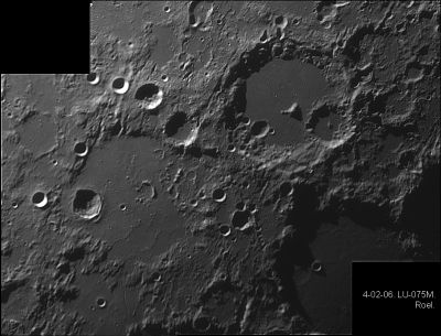
Eric Roel, [/Albategnius Albategnius], [/Hipparchus Hipparchus], [/Klein Klein], [/Halley Halley], [/Hind Hind], [/Horrocks Horrocks], Saunder, [/Parrot Parrot] (with Saunder itself near the photograph's left margin, below the black rectangle)
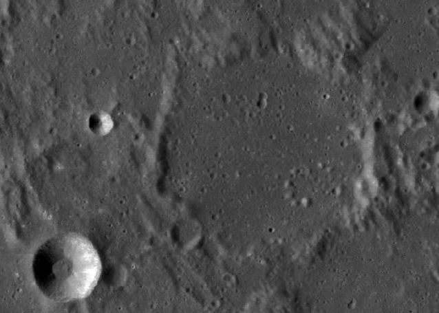
LRO
Images
LPOD Photo Gallery Lunar Orbiter Images Apollo Images
- Although the LPI's search list for orbital Apollo photographs shows nothing for Saunder, this crater WAS captured on several north-looking frames made by Apollo 16's mapping/metric Fairchild camera. One of those frames is AS16-M-0836, which shows Saunder a little bit above and to the right of the frame's centre.
- Research: Danny Caes.
Maps
([/LAC%20zone LAC zone] 77B3) LAC map Geologic map LM map AIC map LTO map
Description
Description: Wikipedia
Additional Information
- Depth data from [/Kurt%20Fisher%20crater%20depths Kurt Fisher database]
- Pike, 1976: 0.64 km
- Westfall, 2000: 0.64 km
- Satellite crater Saunder A is on the [/ALPO%20list%20of%20bright%20ray%20craters ALPO list of bright ray craters].
Ruins of a very ancient large crater southeast of Saunder
- Southeast of Saunder there seems to be a circle-shaped arrangement of elevations that looks more-or-less like the ruins of a large crater the size of Hipparchus. This circle-shaped tendency is depicted on SLC map C5 (System of Lunar Craters, 1966). How much of this ancient crater could be observed during low-sun circumstances? - DannyCaes DannyCaes Jan 21, 2017
Nomenclature
- Named for Samuel Arthur Saunder (1852-1912), a British mathematician and selenographer. In the early 1900's Saunder initiated a program to measure precise positions of lunar craters to extend the accuracy of hand drawn lunar maps. His [/ULCN control points] served as the basis for the positions reported in the IAU's [/Named%20Lunar%20Formations Named Lunar Formations]. Saunder's Presidential Address to the 1903-4 Session of the [/BAA BAA] includes an interesting history of lunar cartography and its usefulness, or lack of usefulness, for detecting changes on the Moon.
- Named by Karl [/M%C3%BCller Müller] in [/Blagg%20and%20M%C3%BCller Named Lunar Formations] in 1935 ([/Whitaker Whitaker], p 229).
LPOD Articles
Bibliography
This page has been edited 1 times. The last modification was made by - tychocrater tychocrater on Jun 13, 2009 3:24 pm - afx3u2
