Hevesy
Contents
Hevesy
| Lat: 83.14°N, Long: 150.1°E, Diam: 49.5 km, Depth: km, Rükl: (farside) |

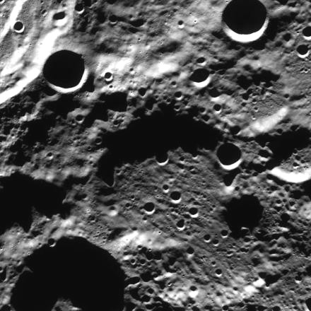
LRO-WAC. Hevesy is the eroded and ejecta flooded crater at center ; Plaskett rim at top left
Images
LPOD Photo Gallery Lunar Orbiter Images
Maps
(LAC zone 1D2) USGS Digital Atlas PDF
Description
Description: Wikipedia
Additional Information
Nomenclature
- Named for Georg Karl Hevesy (1885-1966), a Hungarian chemist and Nobel Prize winner (1943).
- New name approved by the IAU on January 22, 2009.
LPOD Articles
Bibliography