Helberg
Contents
Helberg
| Lat: 22.5°N, Long: 102.2°W, Diam: 62 km, Depth: km, Rükl: (farside) | ||
|
|
|
|


Middle: Lunar Orbiter view from Map-A-Planet.
Right: Color-coded topography LAC 54 from USGS Digital Atlas.
Images
LPOD Photo Gallery Lunar Orbiter Images
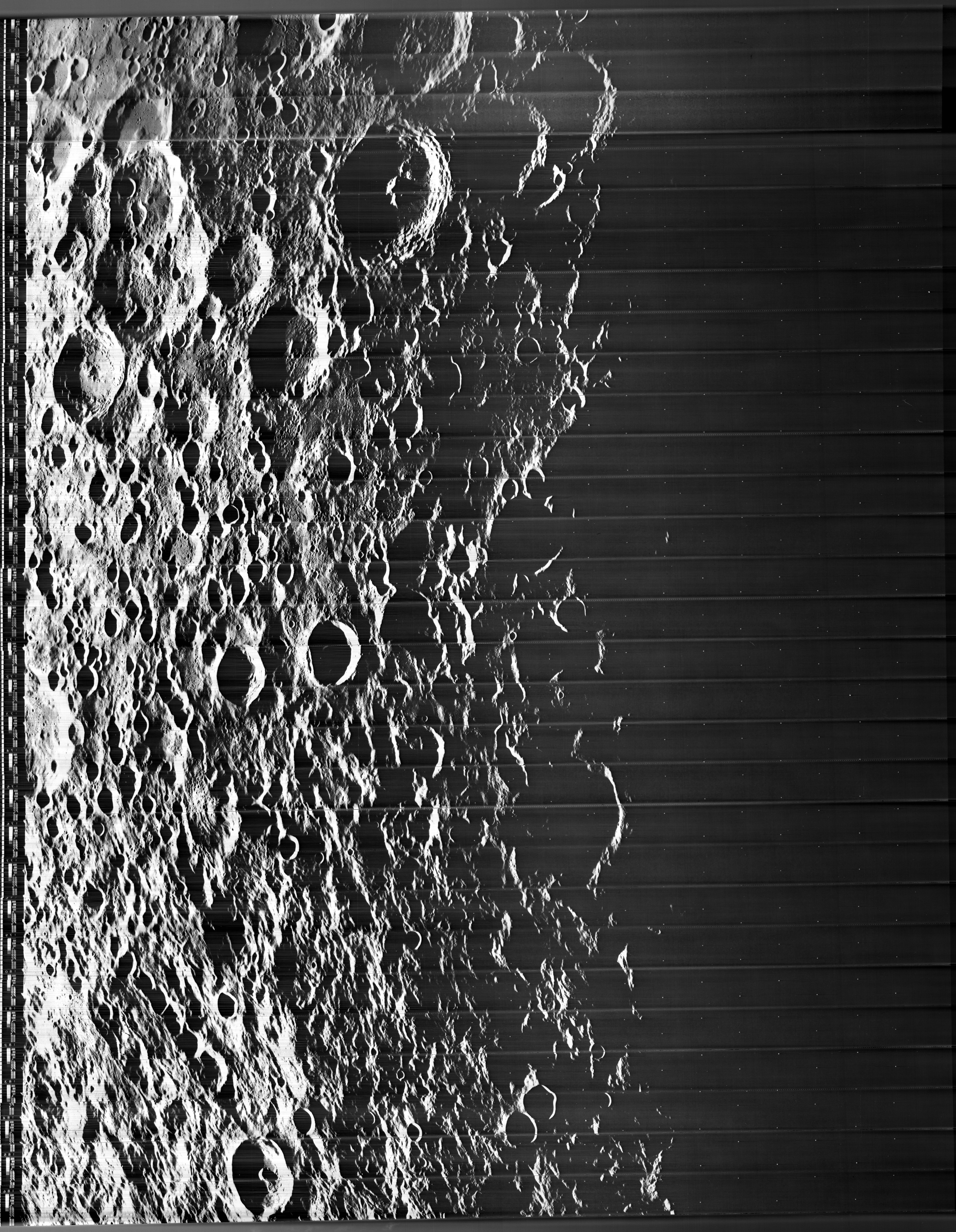
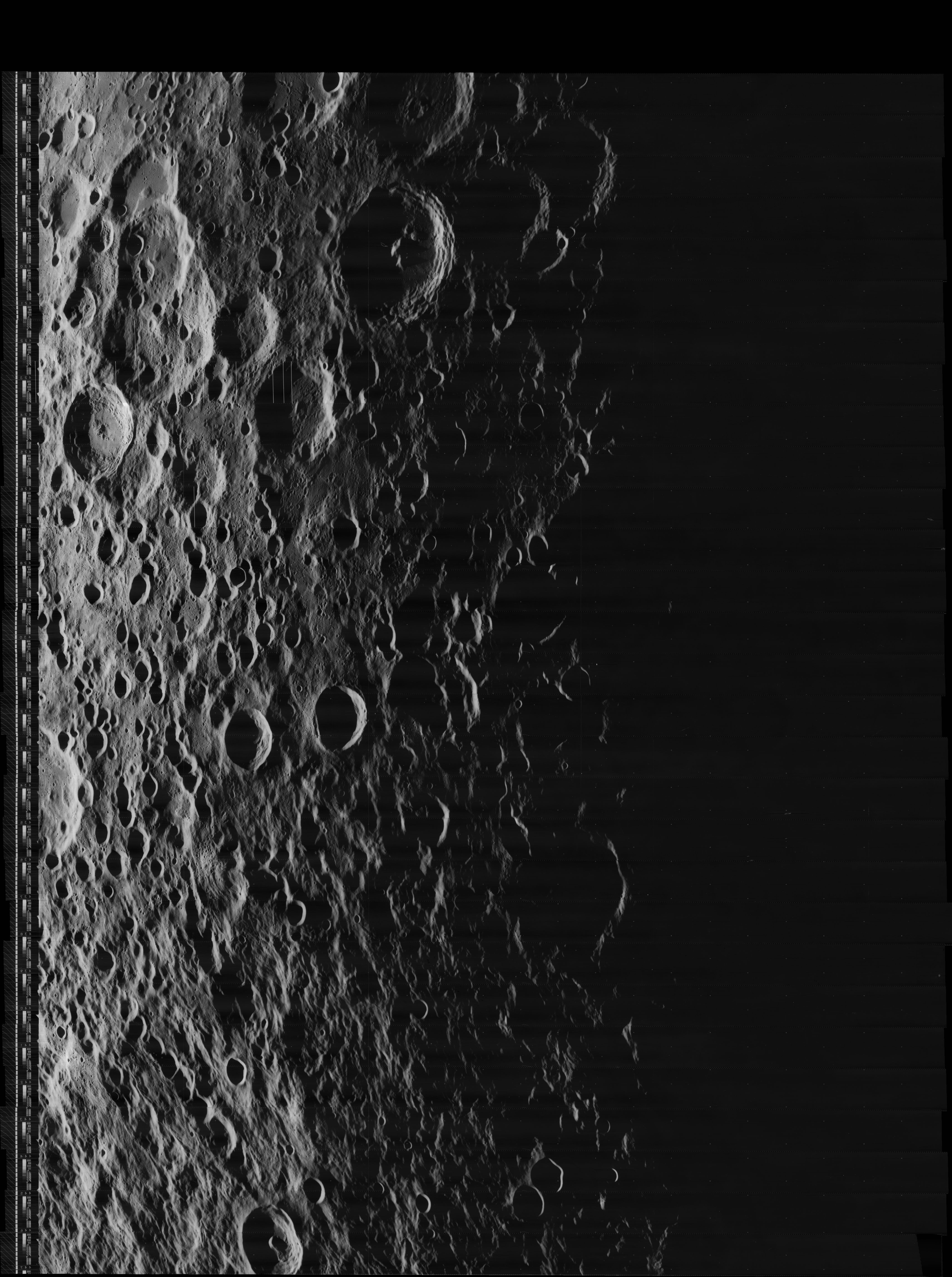
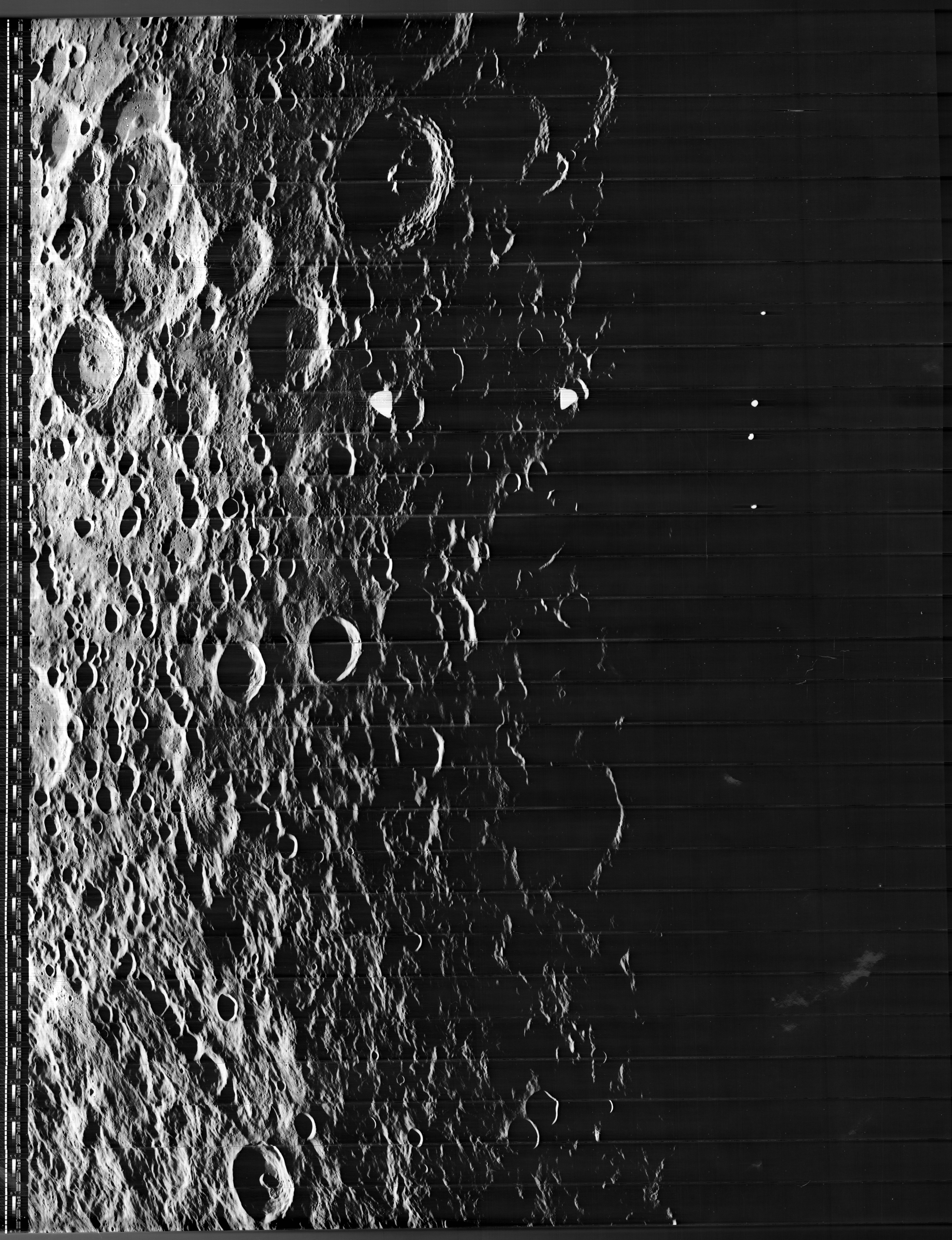
The eastern sunlit inner slopes of Helberg (at the local evening terminator) were captured on Lunar Orbiter V photographs 5013-h2, 5014-h2, 5015-h2, 5016-h2, 5017-h2, 5018-h2, 5019-h2, and 5020-h2.
Research Danny Caes
Maps
(LAC zone 54D2) USGS Digital Atlas PDF
Description
Description: Wikipedia
Additional Information
The east-northeastern one of the two distinct rays from nearby crater Ohm runs over Helberg and Robertson immediately west-southwest of it (see Clementine photograph above). - DannyCaes Aug 15, 2015
Nomenclature
Robert J.; American aeronautical engineer (1906-1967).
 Rimae Helberg (a certain amateur selenologist's unofficial name for the rilles on the floor of Helberg).
LPOD Articles
Lettered Craters

Excerpt from the //USGS Digital Atlas of the Moon.
Bibliography