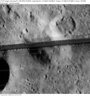
Mons Penck
Contents
Mons Penck
|
Lat: 10.0°S, Long: 21.6°E, Diam: 30 km, Height: 4 km, Rükl 46 |

Images
LPOD Photo Gallery Lunar Orbiter Images Apollo Images
- Two "forgotten" orbital Hasselblads of Kant and nearby Mons Penck, made during the mission of Apollo 12 :
AS12-50-7427 AS12-50-7428 (in both east-looking oblique frames, Kant is the pronounced crater just above centre. Mons Penck itself is the promontory slightly to the upper left of it).
- Wonderful close-ups of Mons Penck were made during the mission of Apollo 16, on orbital ITEK-panoramic frames AS16-P-4540 and AS16-P-4545. In both ITEK-frames, Mons Penck's location is a bit leftward of centre.
Additional research Hasselblad and ITEK-photographs: Danny Caes
Maps
(LAC zone 78C1) LAC map Geologic map LM map LTO map
Description
Description: Wikipedia
Additional Information
Depth data from Kurt Fisher database
- Viscardy, 1985: 4 km
Nomenclature
Albrecht; German geographer (1858-1945).
- The name Mons Penck was provisionally introduced on LTO 78C1 (Oct. 1974).
- Because this is quite a pronounced promontory, it's a mystery why this surface formation didn't receive its own designation before 1974, for example a Greek letter. Chart 72 in the Times Atlas of the Moon doesn't show any kind of designation. - DannyCaes Jul 24, 2014
LPOD Articles
Bibliography