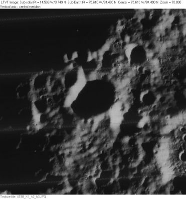
Grignard
Contents
Grignard
|
Lat: 84.49°N, Long: 75.61°W, Diam: 12.2 km, Depth: km, [/R%C3%BCkl%203 Rükl 3] |
Table of Contents
[#Grignard Grignard]
[#Grignard-Images Images]
[#Grignard-Maps Maps]
[#Grignard-Description Description]
[#Grignard-Description: Wikipedia Description: Wikipedia]
[#Grignard-Additional Information Additional Information]
[#Grignard-Nomenclature Nomenclature]
[#Grignard-LPOD Articles LPOD Articles]
[#Grignard-Bibliography Bibliography]

Lunar Orbiter IV Grignard is at the center of this aerial view with the direction towards the Moon's [/north%20pole north pole] up. The dark shadow in the upper left is the floor of [/Hermite Hermite]. None of the other features in the field are named.
Images
LPOD Photo Gallery Lunar Orbiter Images
Maps
([/LAC%20zone LAC zone] 1C2) USGS Digital Atlas PDF Lunar Orbiter version
Description
Description: Wikipedia
Additional Information
Nomenclature
- Named for Victor Grignard (1871-1935), a French chemist and Nobel Prize winner (1912).
- New name approved by the IAU on January 22, 2009.
LPOD Articles
Bibliography
This page has been edited 1 times. The last modification was made by - tychocrater tychocrater on Jun 13, 2009 3:24 pm - afx4